ΠΛΑΤΑΝΑΚΙΑ (58)
ΠΛΑΤΑΝΑΚΙΑ (58) is a bus stop in Pylaia-Chortiatis, Thessaloniki, Central Macedonia. ΠΛΑΤΑΝΑΚΙΑ (58) is situated nearby to the cemetery Κοιμητήρια Πανοράματος, as well as near the monastery Γυναικείο Ησυχαστήριο Γενεσίου της Θεοτόκου.| Tap on a place to explore it |
Places of Interest Nearby
Highlights include Kiretchkioi - Hortakioi WWI Military Cemetery and Anatolia College.
Kiretchkioi - Hortakioi WWI Military Cemetery
Cemetery

Photo: Протогер, CC BY-SA 4.0.
Kiretchkioi - Hortakioi WWI Military Cemetery is situated 3½ km north of ΠΛΑΤΑΝΑΚΙΑ (58).
Anatolia College
School
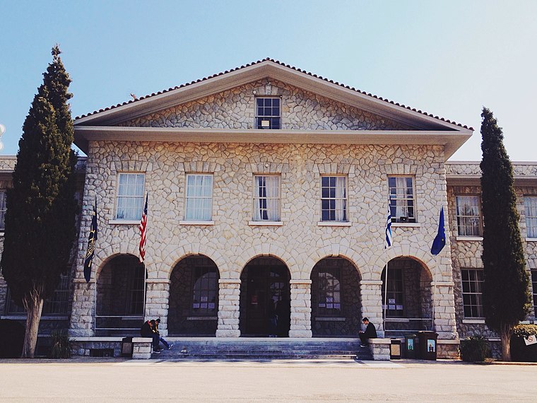
Photo: Pawsp, CC BY-SA 3.0.
Anatolia College (Greek: Κολλέγιο Ανατόλια, also known as the American College, is a private, non-profit, educational institution located in Pylaia, a suburb of Thessaloniki, Greece. Anatolia College is situated 4 km west of ΠΛΑΤΑΝΑΚΙΑ (58).
Places in the Area
Nearby places include Exochi and Chortiatis.
Exochi
Village

Photo: Antoniskapa,pi, CC BY-SA 4.0.
Exochi is a village and a community of the Pylaia-Chortiatis municipality. Before the 2011 local government reform it was part of the municipality of Chortiatis, of which it was a municipal district. Exochi is situated 4 km north of ΠΛΑΤΑΝΑΚΙΑ (58).
Chortiatis
Town

Photo: Christaras A, CC BY-SA 3.0.
Chortiatis is a suburb and a former municipality in the Thessaloniki regional unit, Greece. Since the 2011 Kallikratis local government reform it is part of the municipality Pylaia-Chortiatis, of which it is a municipal unit. Chortiatis is situated 5 km east of ΠΛΑΤΑΝΑΚΙΑ (58).
Pylaia
Suburb

Photo: Wikimedia, CC BY-SA 3.0 gr.
Pylaia is a former municipality in the Thessaloniki Prefecture of Greece. In the 2011 local government reform, Thessaloniki Prefecture became the regional unit of Thessaloniki, and Pylaia became a part of the new municipality of Pylaia-Chortiatis. Pylaia is situated 5 km west of ΠΛΑΤΑΝΑΚΙΑ (58).
ΠΛΑΤΑΝΑΚΙΑ (58)
- Type: Bus stop
- Category: transportation
- Location: Pylaia-Chortiatis, Thessaloniki, Central Macedonia, Greece, Balkans, Europe
- View on OpenStreetMap
Latitude
40.59352° or 40° 35′ 37″ northLongitude
23.04587° or 23° 2′ 45″ eastOpen location code
8GG5H2VW+C8OpenStreetMap ID
node 5615910140OpenStreetMap feature
highway=bus_stopOpenStreetMap feature
public_transport=platform
This page is based on OpenStreetMap, Wikidata, and Wikimedia Commons.
We’d love your help improving our open data sources. Thank you for contributing.
Satellite Map
Discover ΠΛΑΤΑΝΑΚΙΑ (58) from above in high-definition satellite imagery.
Notable Places Nearby
Highlights include Κοιμητήρια Πανοράματος and Γυναικείο Ησυχαστήριο Γενεσίου της Θεοτόκου.
Nearby Places
Explore places such as ΠΛΑΤΑΝΑΚΙΑ (58) and ΟΠΩΡΩΝΕΣ.
Greece: Must-Visit Destinations
Delve into Athens, Thessaloniki, Lesvos, and Arcadia.
Curious Bus Stops to Discover
Uncover intriguing bus stops from every corner of the globe.
About Mapcarta. Data © OpenStreetMap contributors and available under the Open Database License". Text is available under the CC BY-SA 4.0 license, except for photos, directions, and the map. Photo: Wikimedia, CC0.