Harpham Nr Bracey Bridge
Harpham Nr Bracey Bridge is a bus stop in Harpham, East Yorkshire, England. Harpham Nr Bracey Bridge is situated nearby to the meadow Sykes, as well as near the river Kelk Beck.| Tap on a place to explore it |
Places of Interest Nearby
Highlights include Burton Agnes Hall and Church of Saint John of Beverley.
Burton Agnes Hall
 Burton Agnes Hall is an Elizabethan manor house in the village of Burton Agnes, near Driffield in the East Riding of Yorkshire, England. It was built by Sir Henry Griffith in 1601–10 to designs attributed to Robert Smythson. Burton Agnes Hall is situated 1½ miles east of Harpham Nr Bracey Bridge.
Church of Saint John of Beverley
Church

Photo: Stephen Horncastle, CC BY-SA 2.0.
Church of Saint John of Beverley is situated 1 mile southeast of Harpham Nr Bracey Bridge.
Church of St Martin
Church
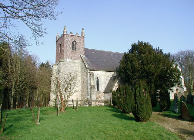
Photo: Paul Glazzard, CC BY-SA 2.0.
Church of St Martin is situated 1 mile south of Harpham Nr Bracey Bridge.
Places in the Area
Nearby places include Ruston Parva and Lowthorpe.
Ruston Parva
Village

Photo: Bill Henderson, CC BY-SA 2.0.
Ruston Parva is a hamlet and former civil parish, now in the parish of Harpham, in the East Riding of Yorkshire, England. It is situated approximately 8 miles south-west of Bridlington and lies just north of the A614.
Lowthorpe
Village

Photo: Andy Beecroft, CC BY-SA 2.0.
Lowthorpe is a village and former civil parish, now in the parish of Harpham, in the East Riding of Yorkshire, England. It is situated approximately 3 miles north-east of Driffield town centre and 7 miles south-west of Bridlington town centre.
Burton Agnes
Village

Photo: Stephen Horncastle, CC BY-SA 2.0.
Burton Agnes is a village and civil parish in the East Riding of Yorkshire, England. It is situated on the A614 road midway between Driffield and Bridlington.
Harpham Nr Bracey Bridge
- Type: Bus stop
- Category: transportation
- Location: Harpham, East Yorkshire, Yorkshire, England, United Kingdom, Britain and Ireland, Europe
- View on OpenStreetMap
Latitude
54.04569° or 54° 2′ 45″ northLongitude
-0.35064° or 0° 21′ 2″ westOpen location code
9C6X2JWX+7POpenStreetMap ID
node 562704611OpenStreetMap feature
highway=bus_stop
This page is based on OpenStreetMap, Wikidata, and Wikimedia Commons.
We’d love your help improving our open data sources. Thank you for contributing.
Satellite Map
Discover Harpham Nr Bracey Bridge from above in high-definition satellite imagery.
Notable Places Nearby
Highlights include Sykes and Kelk Beck.
Nearby Places
Explore places such as A614 Bracey Bridge and Street Croses.
East Yorkshire: Must-Visit Destinations
Delve into Kingston upon Hull, Beverley, Bridlington, and Hornsea.
Curious Bus Stops to Discover
Uncover intriguing bus stops from every corner of the globe.
About Mapcarta. Data © OpenStreetMap contributors and available under the Open Database License". Text is available under the CC BY-SA 4.0 license, except for photos, directions, and the map. Photo: AlasdairW, CC BY-SA 3.0.