Waitrose Ecotech Centre
Waitrose Ecotech Centre is a bus stop in Swaffham, Breckland District, England. Waitrose Ecotech Centre is situated nearby to Swaffham Police Station, as well as near Catholic Church of Our Lady of Pity.| Tap on a place to explore it |
Places of Interest Nearby
Highlights include Church of St Peter and St Paul and Methodist Church.
Church of St Peter and St Paul
Church

Photo: John Salmon, CC BY-SA 2.0.
Church of St Peter and St Paul is situated 3,000 feet south of Waitrose Ecotech Centre.
Methodist Church
Church

Photo: David Dixon, CC BY-SA 2.0.
Methodist Church is situated 3,400 feet south of Waitrose Ecotech Centre.
Kings Arms Public House
Pub
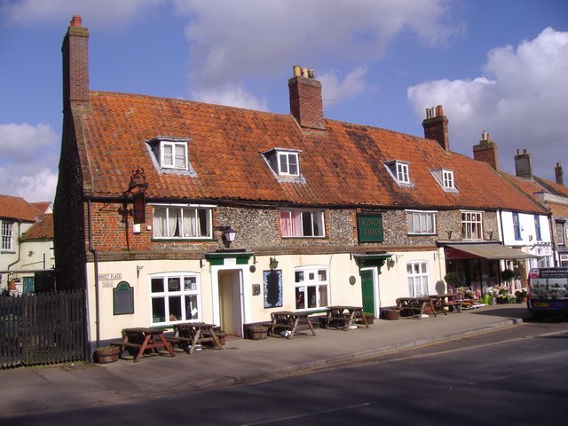
Photo: Mark Hobbs, CC BY-SA 2.0.
Kings Arms Public House is situated 2,700 feet south of Waitrose Ecotech Centre.
Places in the Area
Nearby places include South Acre and Castle Acre.
South Acre
Village
South Acre is a village and civil parish in the English county of Norfolk. The village has almost disappeared, but the remnants are located about 1 km south-west of Castle Acre, 8 km north of the town of Swaffham, 20 km east of the town of King's Lynn and 50 km west of the city of Norwich. South Acre is situated 3 miles north of Waitrose Ecotech Centre.
Castle Acre
Village

Photo: Wikimedia, CC BY-SA 2.0.
Castle Acre is a village and civil parish in the English county of Norfolk. On the River Nar, it is 4 miles north of Swaffham and 26 miles west of Norwich. Castle Acre is situated 3½ miles north of Waitrose Ecotech Centre.
North Pickenham
Village

Photo: John Salmon, CC BY-SA 2.0.
North Pickenham is a village in the Breckland district of mid-Norfolk, East Anglia, England. It lies three miles from the Georgian market town of Swaffham. North Pickenham is situated 3½ miles southeast of Waitrose Ecotech Centre.
Waitrose Ecotech Centre
- Type: Bus stop
- Category: transportation
- Location: Swaffham, Breckland District, Norfolk, East of England, England, United Kingdom, Britain and Ireland, Europe
- View on OpenStreetMap
Latitude
52.65621° or 52° 39′ 22″ northLongitude
0.68791° or 0° 41′ 17″ eastOpen location code
9F42MM4Q+F5OpenStreetMap ID
node 562731509OpenStreetMap feature
highway=bus_stop
This page is based on OpenStreetMap, Wikidata, and Wikimedia Commons.
We’d love your help improving our open data sources. Thank you for contributing.
Satellite Map
Discover Waitrose Ecotech Centre from above in high-definition satellite imagery.
Notable Places Nearby
Highlights include Swaffham Police Station and Catholic Church of Our Lady of Pity.
Nearby Places
Explore places such as Waitrose and Martin Childs Ltd.
Norfolk: Must-Visit Destinations
Delve into Norwich, King’s Lynn, Great Yarmouth, and Norfolk Broads.
Curious Bus Stops to Discover
Uncover intriguing bus stops from every corner of the globe.
About Mapcarta. Data © OpenStreetMap contributors and available under the Open Database License". Text is available under the CC BY-SA 4.0 license, except for photos, directions, and the map. Photo: Wikimedia, CC BY 3.0.