Herrschaftliche Waldung
Herrschaftliche Waldung is a locality in Bad Vöslau, Politischer Bezirk Baden, Lower Austria. Herrschaftliche Waldung is situated nearby to the locality In den Öden, as well as near In den Lerchen.| Tap on a place to explore it |
Places of Interest
Highlights include Jubiläumswarte and Schloss Gainfarn.


Places in the Area
Nearby places include Sooß and Bad Vöslau.
Sooß
Village
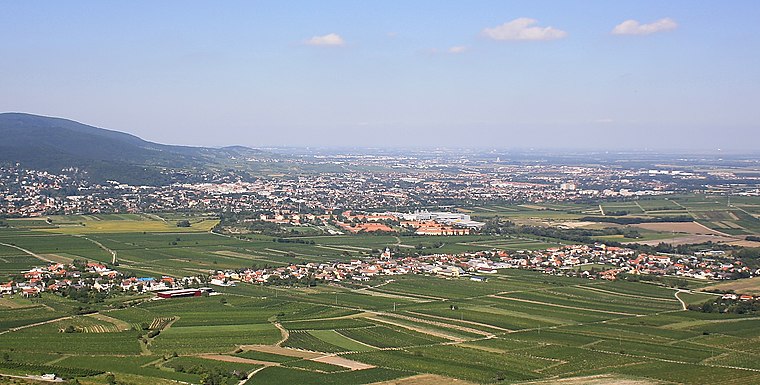
Photo: Bwag, CC BY-SA 3.0.
Sooß is a town in the district of Baden in Lower Austria, Austria.
Bad Vöslau
Town

Photo: Wolfgang glock, CC BY 3.0.
Bad Vöslau is a spa town and municipality in the state of Lower Austria. It is also known as the cradle of the Austrian red wine cultivation. The population, as of 2022, is 12,424.
Kottingbrunn
Village

Photo: Reinhold Stansich, CC BY-SA 3.0.
Kottingbrunn is a town in the district of Baden in Lower Austria in Austria. Kottingbrunn is situated 4 km southeast of Herrschaftliche Waldung.
Herrschaftliche Waldung
- Type: Locality
- Location: Bad Vöslau, Politischer Bezirk Baden, Lower Austria, Austria, Central Europe, Europe
- View on OpenStreetMap
Latitude
47.97566° or 47° 58′ 32″ northLongitude
16.19237° or 16° 11′ 33″ eastOpen location code
8FVRX5GR+7WOpenStreetMap ID
node 5690069156OpenStreetMap feature
place=locality
This page is based on OpenStreetMap, Wikidata, and Wikimedia Commons.
We’d love your help improving our open data sources. Thank you for contributing.
Satellite Map
Discover Herrschaftliche Waldung from above in high-definition satellite imagery.
Localities in the Area
Explore places such as In den Öden and In den Lerchen.
Notable Places Nearby
Highlights include Geburtsstein and Harzberg.
Lower Austria: Must-Visit Destinations
Delve into St. Pölten, Wiener Neustadt, Amstetten, and Klosterneuburg.
Curious Localities to Discover
Uncover intriguing localities from every corner of the globe.
About Mapcarta. Data © OpenStreetMap contributors and available under the Open Database License". Text is available under the CC BY-SA 4.0 license, except for photos, directions, and the map. Photo: Lonezor, CC BY-SA 3.0.