Andoil
Andoil is a gas station in Alameda, California which is located on Mowry Avenue. Andoil is situated nearby to the health club Top Flight Gymnastics, as well as near Holy Trinity Lutheran Church.| Tap on a place to explore it |
Places of Interest Nearby
Highlights include Azevada Park and NewPark Mall.

NewPark Mall
Shopping center
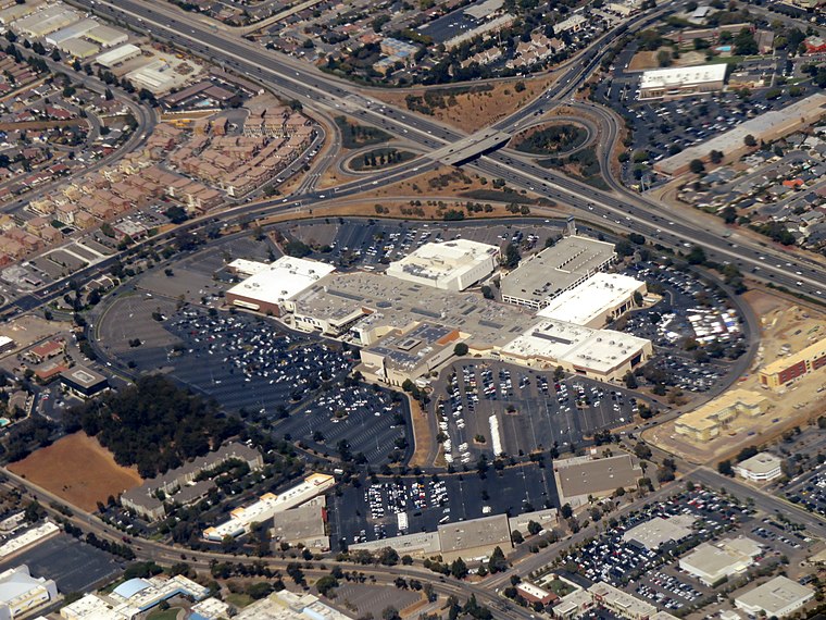
Photo: Pi.1415926535, CC BY-SA 3.0.
NewPark Mall is a 1,161,681 square feet super-regional mall in Newark, California. Opened in August 1980, it currently houses 119 stores. It serves the Tri-City area. NewPark Mall is situated 4,000 feet south of Andoil.
John F Kennedy High School
School
John F. Kennedy High School is a public high school located in Fremont, California, in the United States. It opened in the fall of 1965 with nine buildings. John F Kennedy High School is situated 1 mile southeast of Andoil.
Places in the Area
Nearby places include Fremont and Mowry Landing.
Fremont

Photo: Mactographer, CC BY 2.5.
Fremont is a suburban city in the southern part of the East Bay of the San Francisco Bay Area; it is the 4th largest city in the Bay Area by population.
Mowry Landing
Hamlet
Mowry Landing is a former settlement in Alameda County, California. It is located 2 miles southeast of central Newark on the San Francisco Bay. It lies at an elevation of 10 feet.
Shinn
Hamlet
Shinn was a former unincorporated community around the Western Pacific Railroad station, constructed 1909 on the south bank of Alameda Creek at the end of Shinn Street. Shinn is situated 2 miles north of Andoil.
Andoil
- Type: Gas station
- Address: 4995 Mowry Avenue, Fremont, CA
- Category: transportation
- Location: Alameda, California, United States, North America
- View on OpenStreetMap
Latitude
37.53697° or 37° 32′ 13″ northLongitude
-121.99868° or 121° 59′ 55″ westOpen location code
849WG2P2+QGOpenStreetMap ID
node 571834905OpenStreetMap feature
amenity=fuel
This page is based on OpenStreetMap, Wikidata, and Wikimedia Commons.
We’d love your help improving our open data sources. Thank you for contributing.
Satellite Map
Discover Andoil from above in high-definition satellite imagery.
Notable Places Nearby
Highlights include Top Flight Gymnastics and Holy Trinity Lutheran Church.
Nearby Places
Explore places such as 7-Eleven and Blacow Office Center.
California: Must-Visit Destinations
Delve into San Francisco, Los Angeles, San Diego, and Sacramento.
Curious Gas Stations to Discover
Uncover intriguing gas stations from every corner of the globe.
About Mapcarta. Data © OpenStreetMap contributors and available under the Open Database License". Text is available under the CC BY-SA 4.0 license, except for photos, directions, and the map. Photo: Miskatonic, CC BY 2.5.