Chin Kalagh
Chin Kalagh is a peak in Tehran, Central Iran and has an elevation of 2,801 metres. Chin Kalagh is situated nearby to the locality یونجه زار, as well as near گل سنگ.| Tap on a place to explore it |
Places of Interest
Highlights include Espinas Palace Hotel and Parvaz Park.


Places in the Area
Nearby places include Evin and Emamzadeh Davud.
Evin
Neighborhood
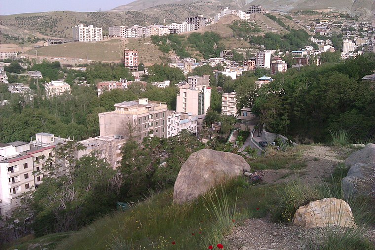
Photo: یوسف سعادت, CC BY-SA 3.0.
Evin is a neighbourhood in the north of Tehran. The district consists of an old section with homes surrounded by orchards and gardens and a new section with high rises and skyscrapers.
Emamzadeh Davud
Village
 Emamzadeh Davud is a village in Sulqan Rural District of Kan District in Tehran County, Tehran province, Iran.
Almahdi - Simun Bolivar
Neighborhood
Simon Bolivar, also called Almahdi, is an affluent neighborhood in north western Tehran located on the hills of Alborz Mountains. Due to the latest census held in Tehran, the hood is home to 53000 people in a 1.36 square kilometers wide area.
Chin Kalagh
- Type: Peak with an elevation of 2,801 metres
- Also known as: “گرده رگ”
- Category: landform
- Location: Tehran, Central Iran, Iran, Middle East, Asia
- View on OpenStreetMap
Latitude
35.8297° or 35° 49′ 47″ northLongitude
51.3548° or 51° 21′ 17″ eastElevation
2,801 metres (9,190 feet)Open location code
8H7HR9H3+VWOpenStreetMap ID
node 5731690831OpenStreetMap feature
natural=peak
This page is based on OpenStreetMap, Wikidata, and Wikimedia Commons.
We’d love your help improving our open data sources. Thank you for contributing.
Satellite Map
Discover Chin Kalagh from above in high-definition satellite imagery.
Places with the Same Name
Discover other places named “Chin Kalagh”.
Localities in the Area
Explore places such as یونجه زار and گل سنگ.
Notable Places Nearby
Highlights include کوه گرده رگ and کوه دراز راه.
Tehran: Must-Visit Destinations
Delve into Tehran, Ray, Varamin, and Damavand.
Curious Peaks to Discover
Uncover intriguing peaks from every corner of the globe.
About Mapcarta. Data © OpenStreetMap contributors and available under the Open Database License". Text is available under the CC BY-SA 4.0 license, except for photos, directions, and the map. Photo: Wikimedia, CC0.