Tunnel de la Soor
Tunnel de la Soor is in Baelen, Arrondissement of Verviers, Wallonia. Tunnel de la Soor is situated nearby to the recreation area Pique-nique de Mefferscheid, as well as near the reservoir Lake Gileppe.| Tap on a place to explore it |
Places of Interest Nearby
Highlights include Lake Gileppe.
Lake Gileppe
Reservoir
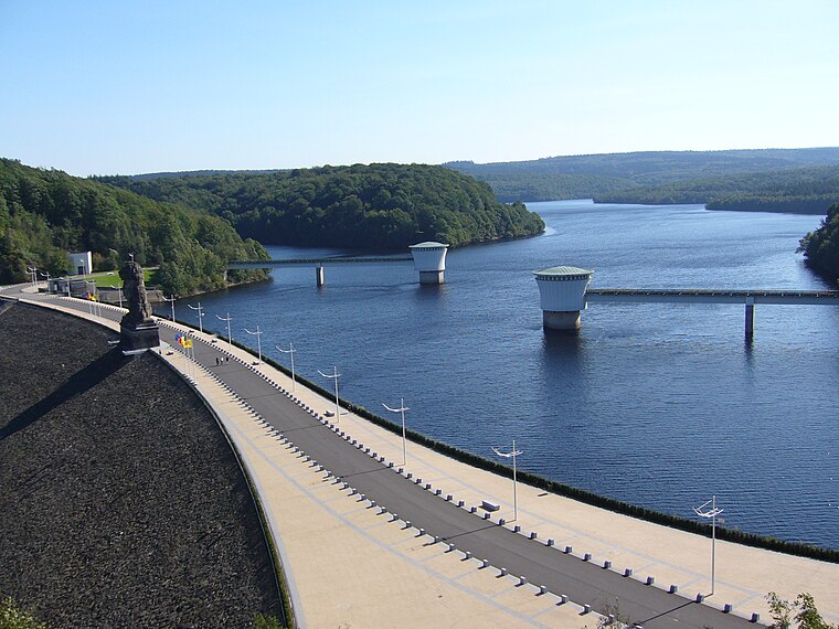
Photo: Alan4630, CC BY-SA 2.5.
Lake Gileppe is located in Wallonia, in the east of Belgium, near the city of Verviers. There is a 78 m high panoramic tower with a restaurant on the top to look at the lake and the landscape. The water volume is 26,400,000 m³ and the area is 1,3 km2. Lake Gileppe is situated 4 km west of Tunnel de la Soor.
Places in the Area
Nearby places include Membach and Eupen.
Membach
Village

Photo: Frinck51, CC BY-SA 3.0.
Membach is a village and district of the municipality of Baelen, located in the province of Liège in Wallonia, Belgium. The first time the village is mentioned in written sources is in a document dated 1172. Membach is situated 6 km northwest of Tunnel de la Soor.
Eupen
 Eupen is a small town in the province of Liège, Belgium. It is the capital of the German-speaking community of Belgium. Large parts of the municipality are covered by forests and the Hautes Fagnes wetlands.
Jalhay
Village

Photo: Paul Hermans, CC BY-SA 3.0.
Jalhay is a municipality of Wallonia located in the province of Liège, Belgium. On 1 January 2006 Jalhay had a total population of 7,953. The total area is 107.75 km. Jalhay is situated 6 km west of Tunnel de la Soor.
Tunnel de la Soor
- Type: Sign
- Categories: information and tourism
- Location: Baelen, Arrondissement of Verviers, Liège, Wallonia, Belgium, Benelux, Europe
- View on OpenStreetMap
Latitude
50.57874° or 50° 34′ 44″ northLongitude
6.045° or 6° 2′ 42″ eastOpen location code
9F28H2HV+FXOpenStreetMap ID
node 5768707026OpenStreetMap feature
tourism=information
This page is based on OpenStreetMap, Wikidata, and Wikimedia Commons.
We’d love your help improving our open data sources. Thank you for contributing.
Satellite Map
Discover Tunnel de la Soor from above in high-definition satellite imagery.
Notable Places Nearby
Highlights include Pique-nique de Mefferscheid and Maison forestière de Hestreux.
Nearby Places
Explore places such as Memorial to the fallen workers and La catastrophe de la Soor.
Curious Places to Discover
Uncover intriguing places from every corner of the globe.
About Mapcarta. Data © OpenStreetMap contributors and available under the Open Database License". Text is available under the CC BY-SA 4.0 license, except for photos, directions, and the map. Photo: Paul Hermans, CC BY-SA 3.0.