Marzagaglia
Marzagaglia is a locality in Gioia del Colle, Bari, Apulia. Marzagaglia is situated nearby to the locality Parco La Mandra, as well as near Le Tufare.| Tap on a place to explore it |
Places of Interest
Highlights include Gioia del Colle Air Base and Gioia del Colle railway station.
Gioia del Colle Air Base
Aerodrome

Photo: Dmottl, Public domain.
Gioia del Colle Air Base is an Italian Air Force base located in the province of Bari, Apulia, Italy, located approximately 1 kilometre south-southeast of Gioia del Colle. Gioia del Colle Air Base is situated 3 km east of Marzagaglia.
Gioia del Colle railway station
Railway station
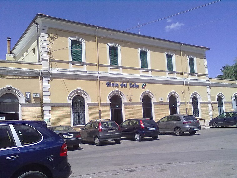
Photo: Vale81, Public domain.
Gioia del Colle is a railway station in Gioia del Colle, Italy. The station is located on the Bari–Taranto railway and Rocchetta Sant'Antonio-Gioia del Colle railway line. Gioia del Colle railway station is situated 3½ km northeast of Marzagaglia.
Places in the Area
Nearby places include Gioia del Colle and Montursi.
Gioia del Colle
Town
 Gioia del Colle is a town and comune of the Metropolitan City of Bari, Apulia, southern Italy. The town is located on the Murge plateau at 360 metres above sea level, between the Adriatic and Ionian seas. Gioia del Colle is situated 4 km northeast of Marzagaglia.
Montursi
Hamlet
Montursi is a frazione or section of the comune of Gioia del Colle, in the Province of Bari, Apulia, southern Italy. It has approximately 700 inhabitants. The neighbouring settlements are Castellaneta, Laterza, Mottola, Matera and Santeramo in Colle. Montursi is situated 6 km southwest of Marzagaglia.
Marzagaglia
- Type: Locality
- Location: Gioia del Colle, Bari, Apulia, Southern Italy, Italy, Europe
- View on OpenStreetMap
Latitude
40.7672° or 40° 46′ 2″ northLongitude
16.8972° or 16° 53′ 50″ eastOpen location code
8FGRQV8W+VVOpenStreetMap ID
node 5783617354OpenStreetMap feature
place=locality
This page is based on OpenStreetMap, Wikidata, and Wikimedia Commons.
We’d love your help improving our open data sources. Thank you for contributing.
Satellite Map
Discover Marzagaglia from above in high-definition satellite imagery.
Localities in the Area
Explore places such as Parco La Mandra and Le Tufare.
Notable Places Nearby
Highlights include Grotta Nardulli and Parco Paolo VI.
Bari: Must-Visit Destinations
Delve into Bari, Alberobello, Molfetta, and Bitonto.
Curious Localities to Discover
Uncover intriguing localities from every corner of the globe.
About Mapcarta. Data © OpenStreetMap contributors and available under the Open Database License". Text is available under the CC BY-SA 4.0 license, except for photos, directions, and the map. Photo: Wikimedia, CC0.