Lovers Mini Market
Lovers Mini Market is a convenience store in Tower Hamlets, Greater London, England which is located on Ben Jonson Road. Lovers Mini Market is situated nearby to Ben Jonson Road Post Office, as well as near the mosque As Sabr.| Tap on a place to explore it |
- Opening hours: 11:00 AM—11:00 PM
- Type: Convenience store
- Address: Unit 13, 71 Ben Jonson Road, London, E1 4SA
Places of Interest Nearby
Highlights include Ragged School Museum and Limehouse station.
Ragged School Museum
Museum

Photo: Pierre Terre, CC BY-SA 2.0.
The Ragged School Museum is a museum in the London Borough of Tower Hamlets. The museum was opened in 1990 in the premises of the former Dr Barnardo's Copperfield Road Ragged School. Ragged School Museum is situated 810 feet east of Lovers Mini Market.
Limehouse station
Railway station
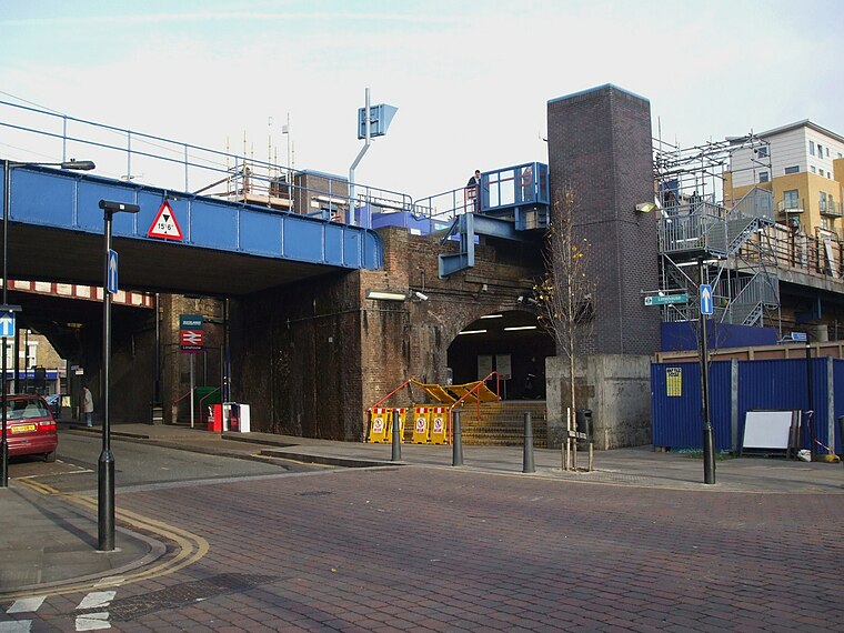
Photo: Sunil060902, CC BY-SA 3.0.
Limehouse is a National Rail and connected Docklands Light Railway station in Limehouse, London, England. It is served by regional services operated by c2c to and from Fenchurch Street and by light metro services provided by the DLR to and from Tower Gateway or Bank. Limehouse station is situated 2,100 feet south of Lovers Mini Market.
St Dunstan’s, Stepney
Church

Photo: Wikimedia, CC BY-SA 3.0.
St Dunstan's, Stepney, is an Anglican church located in Stepney High Street, Stepney, in the London Borough of Tower Hamlets. The church is believed to have been founded, or re-founded, in AD 952 by St Dunstan, the patron saint of bell ringers, metalworkers and Stepney. St Dunstan’s, Stepney is situated 750 feet southwest of Lovers Mini Market.
Places in the Area
Nearby places include Stepney and East London.
Stepney
Suburb

Photo: Tarquin Binary, CC BY-SA 2.5.
Stepney is an area in the London Borough of Tower Hamlets in the East End of London. Stepney is no longer officially defined, and is usually used to refer to a relatively small area.
East London

Photo: Roel Hemkes, CC BY 2.0.
East London is the part of London, England, east of the ancient City of London and north of the River Thames as it begins to widen. East London developed as London's docklands and the primary industrial centre.
East End

Photo: Mark Towning, CC BY 2.0.
The East End is a district of inner London. The boundaries of the East End are not well defined, but for the purposes of this page it covers from the edge of The City to the River Lea or the old boundaries of the former borough of Poplar.
Lovers Mini Market
- Categories: shop and food
- Location: Tower Hamlets, Greater London, England, United Kingdom, Britain and Ireland, Europe
- View on OpenStreetMap
Latitude
51.51821° or 51° 31′ 6″ northLongitude
-0.03916° or 0° 2′ 21″ westOpen location code
9C3XGX96+78OpenStreetMap ID
node 5793556921OpenStreetMap feature
shop=convenience
This page is based on OpenStreetMap, Wikidata, and Wikimedia Commons.
We’d love your help improving our open data sources. Thank you for contributing.
Satellite Map
Discover Lovers Mini Market from above in high-definition satellite imagery.
Notable Places Nearby
Highlights include Ben Jonson Road Post Office and As Sabr.
Nearby Places
Explore places such as Harford Street and Acorn Insurance.
England: Must-Visit Destinations
Delve into London, Manchester, Sheffield, and Leeds.
Curious Convenience Stores to Discover
Uncover intriguing convenience stores from every corner of the globe.
About Mapcarta. Data © OpenStreetMap contributors and available under the Open Database License". Text is available under the CC BY-SA 4.0 license, except for photos, directions, and the map. Photo: sidibousaid, CC BY 2.0.