Mira’s Flower
Mira’s Flower is a flower shop in Waltham Forest, Greater London, England which is located on High Road Leytonstone. Mira’s Flower is situated nearby to the college Learning for Life London, as well as near The Learning Hub.| Tap on a place to explore it |
Places of Interest Nearby
Highlights include Lee Valley VeloPark and Maryland railway station.
Lee Valley VeloPark
Stadium
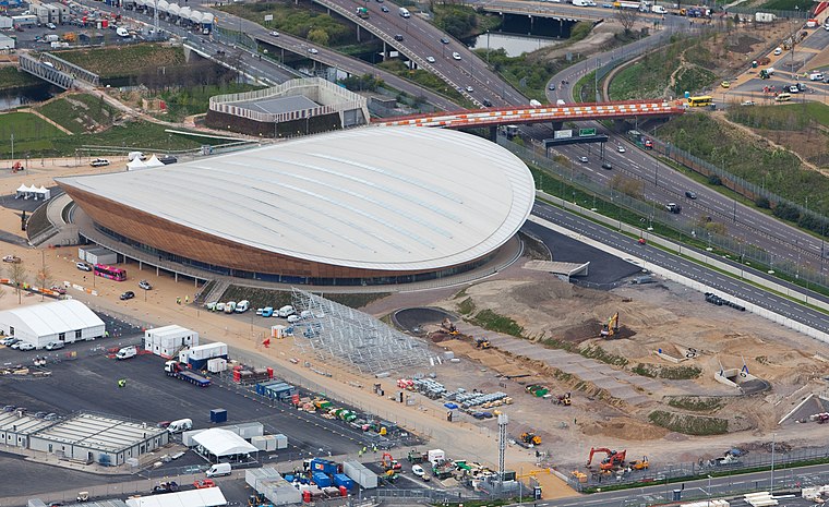 Lee Valley VeloPark is a cycling centre in Queen Elizabeth Olympic Park in Stratford, London, England. It is owned and managed by Lee Valley Regional Park Authority, and it was opened to the public in March 2014. Lee Valley VeloPark is situated 1 mile west of Mira’s Flower.
Maryland railway station
Railway station

Photo: Martinsurveyor, CC BY-SA 4.0.
Maryland railway station is on the Great Eastern Main Line serving the Maryland area of the London Borough of Newham, east London. It is 4 miles 39 chains down the line from London Liverpool Street and is situated between Stratford and Forest Gate. Maryland railway station is situated 2,500 feet south of Mira’s Flower.
Stratford station
Railway station

Photo: Ewan Munro, CC BY-SA 2.0.
Stratford is a major multi-level interchange station serving the town of Stratford and the mixed-use development known as Stratford City, in the London Borough of Newham, East London for London Underground, London Overground, Docklands Light Railway and Elizabeth line services. Stratford station is situated 1 mile southwest of Mira’s Flower.
Places in the Area
Nearby places include Maryland and Temple Mills.
Maryland
Suburb

Photo: Pedleysd, Public domain.
Maryland is a neighbourhood in Stratford in London, United Kingdom. It is in the London Borough of Newham. The community centres around Maryland Station and borders Leytonstone to the north, Stratford New Town to the west and Forest Gate to the east, with Stratford town centre to the south-west.
Temple Mills
Neighborhood
Temple Mills is a district located on the boundary of the London boroughs of Newham and Waltham Forest, with a small part also in Hackney in east London.
East Village
Neighborhood
 East Village is an area in Stratford, East London that was designed and constructed as the Olympic Village of the 2012 Summer Olympics and has been converted for use as a new residential district, complete with independent shops, bars and restaurants.
Mira’s Flower
- Type: Flower shop
- Address: High Road Leytonstone, Leytonstone, London, E11 4HH
- Category: shop
- Location: Waltham Forest, Greater London, England, United Kingdom, Britain and Ireland, Europe
- View on OpenStreetMap
Latitude
51.55289° or 51° 33′ 10″ northLongitude
0.00527° or 0° 0′ 19″ eastOpen location code
9F32H234+54OpenStreetMap ID
node 5812592689OpenStreetMap feature
shop=florist
This page is based on OpenStreetMap, Wikidata, and Wikimedia Commons.
We’d love your help improving our open data sources. Thank you for contributing.
Satellite Map
Discover Mira’s Flower from above in high-definition satellite imagery.
Notable Places Nearby
Highlights include The Learning Hub and Learning for Life London.
Nearby Places
Explore places such as Aress Cash & Carry and Ebony Suite.
England: Must-Visit Destinations
Delve into London, Manchester, Sheffield, and Leeds.
Curious Flower Shops to Discover
Uncover intriguing flower shops from every corner of the globe.
About Mapcarta. Data © OpenStreetMap contributors and available under the Open Database License". Text is available under the CC BY-SA 4.0 license, except for photos, directions, and the map. Photo: sidibousaid, CC BY 2.0.