Soldatenweg Ringmauer
Soldatenweg Ringmauer is in Hermagor-Pressegger See, Hermagor District, Carinthia. Soldatenweg Ringmauer is situated nearby to the peak Hüttenkofel, as well as near the scenic viewpoint Gucklöcher.| Tap on a place to explore it |
Places of Interest Nearby
Highlights include Schulterkofel and Trogkofel.
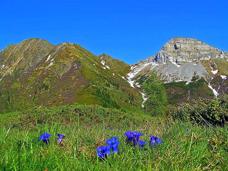
Trogkofel
Peak

Photo: Alpino friulano, CC BY-SA 3.0.
Trogkofel is a mountain of the Carnic Alps lying on the border of Friuli, Italy and Carinthia, Austria. It is located on the main ridge of the Carnics between the Aip Valley to the south and the Gail Valley in the north, and is the second highest mountain on the eastern ridge after Gailtaler Polinik. Trogkofel is situated 3 km southeast of Soldatenweg Ringmauer.
Places in the Area
Nearby places include Rattendorf and Paularo.
Rattendorf
Village

Photo: Codas, CC BY-SA 4.0.
Rattendorf is a village, which is situated 7 km northeast of Soldatenweg Ringmauer.
Paularo
Village

Photo: Wikimedia, CC BY-SA 3.0.
Paularo is a comune in the Regional decentralization entity of Udine in the Italian region of Friuli-Venezia Giulia, located about 110 kilometres northwest of Trieste and about 50 kilometres north of Udine, on the border with Austria. Paularo is situated 8 km southwest of Soldatenweg Ringmauer.
Tröpolach
Village

Photo: Pnapora, CC BY-SA 4.0.
Tröpolach is a village, which is situated 8 km northeast of Soldatenweg Ringmauer.
Soldatenweg Ringmauer
- Type: Sign
- Categories: information and tourism
- Location: Hermagor-Pressegger See, Hermagor District, Carinthia, Austria, Central Europe, Europe
- View on OpenStreetMap
Latitude
46.58268° or 46° 34′ 58″ northLongitude
13.18216° or 13° 10′ 56″ eastOpen location code
8FRMH5MJ+3VOpenStreetMap ID
node 5821287023OpenStreetMap feature
tourism=information
This page is based on OpenStreetMap, Wikidata, and Wikimedia Commons.
We’d love your help improving our open data sources. Thank you for contributing.
Satellite Map
Discover Soldatenweg Ringmauer from above in high-definition satellite imagery.
Notable Places Nearby
Highlights include Gucklöcher and Hüttenkofel.
Nearby Places
Explore places such as Soldatenweg Ringmauer and Ringmauer Kreuz.
Carinthia: Must-Visit Destinations
Delve into Klagenfurt, Villach, Wörthersee, and Spittal an der Drau.
Curious Places to Discover
Uncover intriguing places from every corner of the globe.
About Mapcarta. Data © OpenStreetMap contributors and available under the Open Database License". Text is available under the CC BY-SA 4.0 license, except for photos, directions, and the map. Photo: Wikimedia, CC BY-SA 3.0.