Breitenfeldkreuz
Breitenfeldkreuz is a wayside cross in Langenlois, Krems District, Lower Austria. Breitenfeldkreuz is situated nearby to the peak Reitberg, as well as near Laabenberg.| Tap on a place to explore it |
Places of Interest Nearby
Highlights include Pfarrkirche hl. Pankraz, Schiltern and Pestkapelle Unbefleckte Empfängnis.
Pfarrkirche hl. Pankraz, Schiltern
Church

Photo: Elke Pfeifer, CC BY-SA 3.0 at.
Pfarrkirche hl. Pankraz, Schiltern is a church, which is situated 1½ km west of Breitenfeldkreuz.
Pestkapelle Unbefleckte Empfängnis
Church

Photo: Elke Pfeifer, CC BY-SA 3.0 at.
Pestkapelle Unbefleckte Empfängnis is a church, which is situated 1½ km west of Breitenfeldkreuz.
hl. Johannes Nepomuk
Wayside shrine

Photo: Elke Pfeifer, CC BY-SA 3.0 at.
hl. Johannes Nepomuk is a wayside shrine, which is situated 1½ km west of Breitenfeldkreuz.
Places in the Area
Nearby places include Zöbing and Maiersch.
Zöbing
Village

Photo: Maclemo, CC BY-SA 4.0.
Zöbing is a village, which is situated 4 km southeast of Breitenfeldkreuz.

Freischling
Village
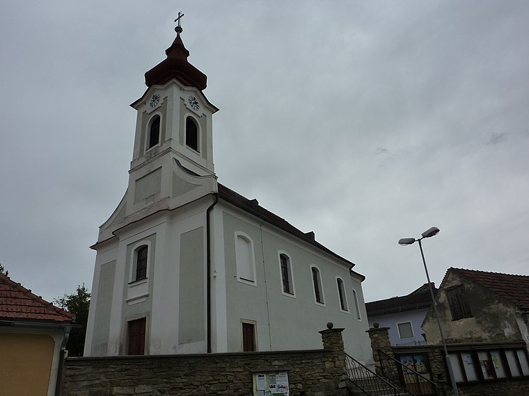
Photo: BSonne, CC BY-SA 3.0.
Freischling is a village, which is situated 8 km northeast of Breitenfeldkreuz.
Breitenfeldkreuz
- Type: Wayside cross
- Category: historic site
- Location: Langenlois, Krems District, Lower Austria, Austria, Central Europe, Europe
- View on OpenStreetMap
Latitude
48.51136° or 48° 30′ 41″ northLongitude
15.64564° or 15° 38′ 44″ eastOpen location code
8FWQGJ6W+G7OpenStreetMap ID
node 5856269398OpenStreetMap feature
historic=wayside_cross
This page is based on OpenStreetMap, Wikidata, and Wikimedia Commons.
We’d love your help improving our open data sources. Thank you for contributing.
Satellite Map
Discover Breitenfeldkreuz from above in high-definition satellite imagery.
Notable Places Nearby
Highlights include Reitberg and Weinkeller.
Nearby Places
Explore places such as Rotes Kreuz and Reith bei Langenlois Nord.
Lower Austria: Must-Visit Destinations
Delve into St. Pölten, Wiener Neustadt, Amstetten, and Klosterneuburg.
Curious Wayside Crosses to Discover
Uncover intriguing wayside crosses from every corner of the globe.
About Mapcarta. Data © OpenStreetMap contributors and available under the Open Database License". Text is available under the CC BY-SA 4.0 license, except for photos, directions, and the map. Photo: Lonezor, CC BY-SA 3.0.