Belvédère de la Sablière
Belvédère de la Sablière is a scenic viewpoint in Viroflay, Arrondissement of Versailles, Île-de-France. Belvédère de la Sablière is situated nearby to the sports venue Centre sportif des Bertisettes, as well as near Piscine des Bertisettes.| Tap on a place to explore it |
Places of Interest Nearby
Highlights include Viroflay-Rive-Gauche station and Église Saint-Eustache de Viroflay.
Viroflay-Rive-Gauche station
Railway station

Photo: Geralix, CC BY-SA 3.0.
Viroflay-Rive-Gauche station is a railway station, which is situated 640 metres northeast of Belvédère de la Sablière.
Église Saint-Eustache de Viroflay
Church

Photo: ²°¹°°, Public domain.
Église Saint-Eustache de Viroflay is a church, which is situated 510 metres northeast of Belvédère de la Sablière.
Gare de Porchefontaine
Railway station

Photo: Henrysalome, CC BY-SA 3.0.
Gare de Porchefontaine is a railway station, which is situated 1 km west of Belvédère de la Sablière.
Places in the Area
Nearby places include Viroflay and Porchefontaine.
Viroflay
Town
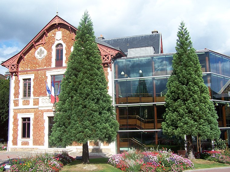
Photo: Henrysalome, CC BY-SA 3.0.
Viroflay is a commune in the Yvelines department in the Île-de-France in north-central France. It is located in the south-western suburbs of Paris 14.1 km from the center and 3 km from the Palace of Versailles.
Porchefontaine
Suburb
Photo: Henrysalome, CC BY-SA 3.0.
Porchefontaine is a neighborhood in the south-east of Versailles, in Yvelines department of France. It was a living working class residential area. Since the 1970s, the neighborhood declined in activity and population.

Belvédère de la Sablière
- Type: Scenic viewpoint
- Category: tourism
- Location: Viroflay, Arrondissement of Versailles, Yvelines, Île-de-France, France, Europe
- View on OpenStreetMap
Latitude
48.79567° or 48° 47′ 44″ northLongitude
2.16706° or 2° 10′ 1″ eastOpen location code
8FW4Q5W8+7ROpenStreetMap ID
node 5866567028OpenStreetMap feature
tourism=viewpoint
This page is based on OpenStreetMap, Wikidata, and Wikimedia Commons.
We’d love your help improving our open data sources. Thank you for contributing.
Satellite Map
Discover Belvédère de la Sablière from above in high-definition satellite imagery.
Notable Places Nearby
Highlights include Centre sportif des Bertisettes and Piscine des Bertisettes.
Nearby Places
Explore places such as La Buse and La Digitale.
Île-de-France: Must-Visit Destinations
Delve into Paris, Versailles, Boulogne-Billancourt, and Paris Charles de Gaulle Airport.
Curious Scenic Viewpoints to Discover
Uncover intriguing scenic viewpoints from every corner of the globe.
About Mapcarta. Data © OpenStreetMap contributors and available under the Open Database License". Text is available under the CC BY-SA 4.0 license, except for photos, directions, and the map. Photo: Inkey, CC BY-SA 3.0.