posht shahr
posht shahr is a neighborhood in Hormozgan, Iran. posht shahr is situated nearby to the neighborhood گلکنی, as well as near hosein abad.| Tap on a place to explore it |
Places of Interest
Highlights include Kolah Farangi Mansion (Bandar Abbas) and Vishnu Temple.
Kolah Farangi Mansion (Bandar Abbas)
Manor estate
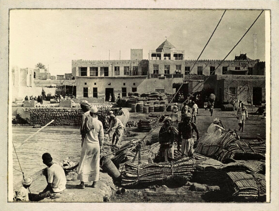
Photo: Wikimedia, Public domain.
Kolah Farangi Mansion (Bandar Abbas) is a manor estate.
Vishnu Temple
Hindu temple

Photo: Hasanbardal, CC BY-SA 4.0.
The Vishnu Temple in Bandar Abbas, Iran is a historical monument constructed in 1892 during the reign of Mohammad Hassan Khan Sa'd-ol-Malek and dedicated to the Hindu god Vishnu.
Places in the Area
Nearby places include Bandar Abbas and Kalatu.
Bandar Abbas
 Bandar Abbas is a port city in the Central District of Bandar Abbas County, Hormozgan province, Iran, serving as capital of the province, the county, and the district.
Kalatu
Village
Kalatu is a village in Tazian Rural District, in the Central District of Bandar Abbas County, Hormozgan Province, Iran. At the 2016 census, its population was 328, in 40 families. Kalatu is situated 7 km west of posht shahr.
posht shahr
- Type: Neighborhood
- Category: locality
- Location: Hormozgan, Iran, Middle East, Asia
- View on OpenStreetMap
Latitude
27.17419° or 27° 10′ 27″ northLongitude
56.26165° or 56° 15′ 42″ eastOpen location code
7HVR57F6+MMOpenStreetMap ID
node 5898551755OpenStreetMap feature
place=neighbourhood
This page is based on OpenStreetMap, Wikidata, and Wikimedia Commons.
We’d love your help improving our open data sources. Thank you for contributing.
Satellite Map
Discover posht shahr from above in high-definition satellite imagery.
Places with the Same Name
Discover other places named “posht shahr”.
Localities in the Area
Explore places such as گلکنی and hosein abad.
Notable Places Nearby
Highlights include چمن مصنوعی امام علی and بیمارستان صاحب الزمان.
Iran: Must-Visit Destinations
Delve into Tehran, Isfahan, Tabriz, and Sistan and Baluchestan.
Curious Neighborhoods to Discover
Uncover intriguing neighborhoods from every corner of the globe.
About Mapcarta. Data © OpenStreetMap contributors and available under the Open Database License". Text is available under the CC BY-SA 4.0 license, except for photos, directions, and the map. Photo: Wikimedia, GFDL.