Onverflout
Onverflout is a work of art in Sint-Michielsgestel Municipality, North Brabant. Onverflout is situated nearby to the church Kapelletje aan de Keer, as well as near Sint-Jacobus de Meerderekerk.| Tap on a place to explore it |
Places of Interest Nearby
Highlights include Sint-Jacobus de Meerderekerk and Pettelaarse Schans.
Sint-Jacobus de Meerderekerk
Church

Photo: Michielverbeek, CC BY-SA 3.0.
Sint-Jacobus de Meerderekerk is a church, which is situated 1 km east of Onverflout.
Pettelaarse Schans
Park
 Pettelaarse Schans is a park, which is situated 2½ km northwest of Onverflout.
St. John’s Cathedral
Church
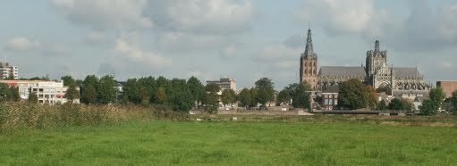
Photo: Klankbeeld, CC BY-SA 4.0.
The Catholic Cathedral Church of St. John of 's-Hertogenbosch, North Brabant, is the height of Gothic architecture in the Netherlands. It has an extensive and richly decorated interior, and serves as the cathedral for the bishopric of 's-Hertogenbosch. St. John’s Cathedral is situated 4 km northwest of Onverflout.
Places in the Area
Nearby places include Den Dungen and Maaskantje.
Den Dungen
Village
Photo: Michielverbeek, CC BY-SA 3.0.
Den Dungen is a village in the Dutch province of North Brabant. It is located in the municipality of Sint-Michielsgestel next to the village Maaskantje.
Maaskantje
Village

Photo: Wikimedia, CC BY-SA 4.0.
Maaskantje is a village in the province of North Brabant, Netherlands. The village is part of the municipality of Sint-Michielsgestel, southeast of 's-Hertogenbosch.
Haanwijk
Hamlet

Photo: Kasteelbeer, CC BY-SA 3.0 nl.
Haanwijk is an estate and nature reserve with a manor house near Sint-Michielsgestel in North-Brabant, Netherlands. Haanwijk is situated 2½ km southwest of Onverflout.
Onverflout
- Type: Work of art
- Categories: tower and tourism
- Location: Sint-Michielsgestel Municipality, North Brabant, Southern Netherlands, Netherlands, Benelux, Europe
- View on OpenStreetMap
Latitude
51.66721° or 51° 40′ 2″ northLongitude
5.35496° or 5° 21′ 18″ eastInception
2018Open location code
9F37M983+VXOpenStreetMap ID
node 5936863417OpenStreetMap feature
man_made=towerOpenStreetMap feature
tourism=artwork
This page is based on OpenStreetMap, Wikidata, and Wikimedia Commons.
We’d love your help improving our open data sources. Thank you for contributing.
Satellite Map
Discover Onverflout from above in high-definition satellite imagery.
Notable Places Nearby
Highlights include Kapelletje aan de Keer and Litserborg.
Nearby Places
Explore places such as Linie van 1629 - Kampement van Brederode and Boomkwekerij van den Berk.
North Brabant: Must-Visit Destinations
Delve into Eindhoven, ’s-Hertogenbosch, Breda, and Tilburg.
Curious Work Of Arts to Discover
Uncover intriguing work of arts from every corner of the globe.
About Mapcarta. Data © OpenStreetMap contributors and available under the Open Database License". Text is available under the CC BY-SA 4.0 license, except for photos, directions, and the map. Photo: WiDi, CC BY-SA 3.0.