Skjellerhøj
Skjellerhøj is an archaeological site in Thisted Municipality, North Jutland. Skjellerhøj is situated nearby to the archaeological site Gangerhøj, as well as near Jespershøj.| Tap on a place to explore it |
Places of Interest Nearby
Highlights include Vester Vandet Church and Øster Vandet Church.
Vester Vandet Church
Church
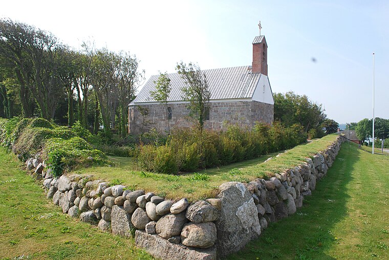
Photo: Erik Christensen, CC BY-SA 3.0.
Vester Vandet Church is situated 1½ km northwest of Skjellerhøj.
Øster Vandet Church
Church

Photo: Bococo, CC BY-SA 3.0.
Øster Vandet Church is situated 1½ km southeast of Skjellerhøj.
Vandet Sø
Lake

Photo: Rolf Engstrand, CC BY 2.5.
Vandet Sø is a lake, which is situated 2½ km northwest of Skjellerhøj.
Places in the Area
Nearby places include Nors and Sjørring.
Nors
Village

Photo: Beethoven9, CC BY-SA 4.0.
Nors is a small town, with a population of 1,110, in Thy district, North Jutland Region in Denmark. It is located in Thisted Municipality 14 km southeast of Hanstholm and 9 km north of Thisted. Nors is situated 5 km east of Skjellerhøj.
Sjørring
Village

Photo: Bococo, CC BY-SA 3.0.
Sjørring is a small railway town in Thisted Municipality in North Jutland Region, Denmark. As of 1 January 2025 it has a population of 724. It is located in the central part of the Thy district 7 km west of Thisted. Sjørring is situated 6 km south of Skjellerhøj.
Klitmøller
Village

Photo: Cold Hawaii, CC BY-SA 2.0.
Klitmøller is a Danish town in Thisted Municipality, the North Denmark Region. Klitmøller has a population of 1,277. The town is located 11 km southwest of Hanstholm and 18 km northwest of Thisted. Klitmøller is situated 7 km northwest of Skjellerhøj.
Skjellerhøj
- Type: Archaeological site
- Description: ancient monument in Thisted Municipality (17985)
- Categories: tumulus, historic site, tourist attraction, and tourism
- Location: Thisted Municipality, North Jutland, Jutland, Denmark, Nordic countries, Europe
- View on OpenStreetMap
Latitude
57.0037° or 57° 0′ 13″ northLongitude
8.59923° or 8° 35′ 57″ eastOpen location code
9F9C2H3X+FMOpenStreetMap ID
node 5940952911OpenStreetMap feature
historic=archaeological_siteWikidata ID
Q30116651
This page is based on OpenStreetMap, Wikidata, and Wikimedia Commons.
We’d love your help improving our open data sources. Thank you for contributing.
Satellite Map
Discover Skjellerhøj from above in high-definition satellite imagery.
In Other Languages
“Skjellerhøj” goes by many names.
- Danish: “Skjellerhøj”
Notable Places Nearby
Highlights include Gangerhøj and Jespershøj.
Nearby Places
Explore places such as Tøfting and Tavs & Lam.
North Jutland: Must-Visit Destinations
Delve into Aalborg, Frederikshavn, Skagen, and Hjørring.
Curious Archaeological Sites to Discover
Uncover intriguing archaeological sites from every corner of the globe.
About Mapcarta. Data © OpenStreetMap contributors and available under the Open Database License". Text is available under the CC BY-SA 4.0 license, except for photos, directions, and the map. Photo: Slaunger, CC BY-SA 3.0.