Avio Support
Avio Support is an office in King County, Puget Sound, Washington. Avio Support is situated nearby to Kirkland Cemetery, as well as near Salt House Church.| Tap on a place to explore it |
Places of Interest Nearby
Highlights include Forbes Creek and Lake Washington High School.
Forbes Creek
Lake

Photo: Brianhe, CC BY-SA 4.0.
Forbes Creek is a small, moderately sloping creek wholly within the city of Kirkland, Washington. From its headwaters on the Rose Hill moraine to its outlet at Juanita Bay is c.
Lake Washington High School
School

Photo: Architectsea, CC BY-SA 3.0.
Lake Washington High School is a four-year public high school in Kirkland, Washington, a suburb east of Seattle. Lake Washington High School is situated 2,300 feet south of Avio Support.

Places in the Area
Nearby places include Kirkland and Houghton.
Kirkland
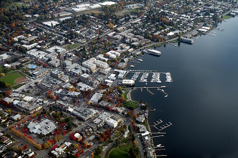
Photo: Jelson25, CC BY-SA 3.0.
Kirkland is a charming city of 93,000 in King County, Washington, across from Seattle on the east side of Lake Washington.
Houghton
Neighborhood
Houghton is one of the lakeside neighborhoods of the city of Kirkland, Washington. Consisting mostly of upscale, single-family homes, Houghton overlooks Lake Washington and is one of the wealthier districts of the Eastside suburbs of Seattle. Houghton is situated 1½ miles southwest of Avio Support.
Juanita
Suburb
Juanita is a neighborhood of Kirkland, Washington located along the northeast edge of Lake Washington. The area, one of the Eastside's most historic, was an unincorporated area governed by King County until it was gradually annexed by Kirkland in 1967, 1988, and 2011. Juanita is situated 2 miles northwest of Avio Support.
Avio Support
- Type: Business
- Category: office
- Location: King County, Puget Sound, Washington, Pacific Northwest, United States, North America
- View on OpenStreetMap
Latitude
47.67975° or 47° 40′ 47″ northLongitude
-122.18182° or 122° 10′ 55″ westOpen location code
84VVMRH9+W7OpenStreetMap ID
node 6001268787OpenStreetMap feature
office=company
This page is based on OpenStreetMap, Wikidata, and Wikimedia Commons.
We’d love your help improving our open data sources. Thank you for contributing.
Satellite Map
Discover Avio Support from above in high-definition satellite imagery.
Notable Places Nearby
Highlights include Kirkland Cemetery and Salt House Church.
Nearby Places
Explore places such as The Goddard School and Coldwell Banker.
King County: Must-Visit Destinations
Delve into Seattle, Bellevue, Seattle-Tacoma International Airport, and Capitol Hill-Central District.
Curious Places to Discover
Uncover intriguing places from every corner of the globe.
About Mapcarta. Data © OpenStreetMap contributors and available under the Open Database License". Text is available under the CC BY-SA 4.0 license, except for photos, directions, and the map. Photo: Lumpytrout, CC BY-SA 3.0.