Meierei der Vorwerker Diakonie
Meierei der Vorwerker Diakonie is a farm shop in Stockelsdorf, Ostholstein, Schleswig-Holstein. Meierei der Vorwerker Diakonie is situated nearby to the government office THW Regionalstelle Lübeck, as well as near Entsorgungsbetriebe Lübeck (Kanalnetzbetrieb).| Tap on a place to explore it |
Places of Interest Nearby
Highlights include St.-Markus-Kirche and Tremser Teich.
St.-Markus-Kirche
Church

Photo: Nur Luis, CC BY-SA 4.0.
St.-Markus-Kirche is a church, which is situated 1 km southeast of Meierei der Vorwerker Diakonie.

Niederländische Ehrenanlage
Memorial

Photo: 1970gemini, CC BY-SA 4.0.
Niederländische Ehrenanlage is a memorial, which is situated 800 metres west of Meierei der Vorwerker Diakonie.
Places in the Area
Nearby places include Stockelsdorf and Lübeck.
Stockelsdorf
Town

Photo: Genet, CC BY-SA 3.0.
Stockelsdorf is a municipality in the district of Ostholstein, in Schleswig-Holstein, Germany. It is situated directly northwest of Lübeck and forms an agglomeration with the easterly town of Bad Schwartau.
Lübeck
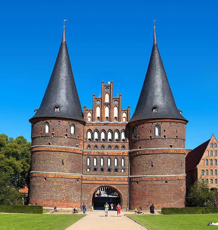
Photo: Dr. Chriss, CC BY-SA 3.0 de.
The Hanseatic City of Lübeck is the largest German port on the Baltic Sea and the second-largest city in Schleswig-Holstein, situated at the mouth of the river Trave.
Israelsdorf
Village

Photo: 1970gemini, CC BY-SA 3.0.
Israelsdorf is a village, which is situated 4½ km east of Meierei der Vorwerker Diakonie.
Meierei der Vorwerker Diakonie
- Type: Farm shop
- Categories: shop and food
- Location: Stockelsdorf, Ostholstein, Schleswig-Holstein, Germany, Central Europe, Europe
- View on OpenStreetMap
Latitude
53.89926° or 53° 53′ 57″ northLongitude
10.67468° or 10° 40′ 29″ eastOpen location code
9F5GVMXF+PVOpenStreetMap ID
node 601624037OpenStreetMap feature
shop=farm
This page is based on OpenStreetMap, Wikidata, and Wikimedia Commons.
We’d love your help improving our open data sources. Thank you for contributing.
Satellite Map
Discover Meierei der Vorwerker Diakonie from above in high-definition satellite imagery.
Notable Places Nearby
Highlights include THW Regionalstelle Lübeck and Entsorgungsbetriebe Lübeck (Kanalnetzbetrieb).
Nearby Places
Explore places such as 2.Hand Kaufhaus and Blockheizkraftwerk Ratekauer Weg.
Schleswig-Holstein: Must-Visit Destinations
Delve into Kiel, Lübeck, Flensburg, and Heligoland.
Curious Farm Shops to Discover
Uncover intriguing farm shops from every corner of the globe.
About Mapcarta. Data © OpenStreetMap contributors and available under the Open Database License". Text is available under the CC BY-SA 4.0 license, except for photos, directions, and the map. Photo: Ypsilon from Finland, CC0.