Tiefer Fachinger Grundstollen
Tiefer Fachinger Grundstollen is an adit in Birlenbach, Rhein-Lahn-Kreis, Rhineland-Palatinate. Tiefer Fachinger Grundstollen is situated nearby to the garden Kräutergarten am Nonnenpfad, as well as near Playground Fachingen.| Tap on a place to explore it |
Places of Interest Nearby
Highlights include Steinbruch Fachingen and Fachingen (Lahn).
Steinbruch Fachingen
Nature reserve

Photo: Wikimedia, CC BY-SA 4.0.
Steinbruch Fachingen is a nature reserve.
Fachingen (Lahn)
Railway stop

Photo: Wikimedia, CC BY-SA 3.0.
Fachingen (Lahn) is a railway stop, which is situated 740 metres north of Tiefer Fachinger Grundstollen.
Castle Balduinstein
Castle
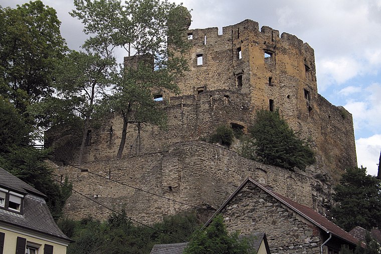
Photo: Wikimedia, CC BY-SA 2.0 de.
Castle Balduinstein is situated 2 km southwest of Tiefer Fachinger Grundstollen.
Places in the Area
Nearby places include Fachingen and Balduinstein.

Balduinstein
Village

Photo: Whgler, CC BY-SA 4.0.
Balduinstein is a municipality in the district of Rhein-Lahn, in Rhineland-Palatinate, in western Germany. It belongs to the association community of Diez.
Altendiez
Village

Photo: Fingalo, CC BY-SA 2.0 de.
Altendiez is a municipality in the district of Rhein-Lahn, in Rhineland-Palatinate, in western Germany. It belongs to the association community of Diez.
Tiefer Fachinger Grundstollen
- Type: Adit
- Category: industry
- Location: Birlenbach, Rhein-Lahn-Kreis, Rhineland-Palatinate, Germany, Central Europe, Europe
- View on OpenStreetMap
Latitude
50.35516° or 50° 21′ 19″ northLongitude
7.99217° or 7° 59′ 32″ eastOpen location code
9F299X4R+3VOpenStreetMap ID
node 6020187396OpenStreetMap feature
man_made=adit
This page is based on OpenStreetMap, Wikidata, and Wikimedia Commons.
We’d love your help improving our open data sources. Thank you for contributing.
Satellite Map
Discover Tiefer Fachinger Grundstollen from above in high-definition satellite imagery.
Notable Places Nearby
Highlights include Kräutergarten am Nonnenpfad and Playground Fachingen.
Nearby Places
Explore places such as Pumpstation and Schutzhütte Kuheiche.
Rhineland-Palatinate: Must-Visit Destinations
Delve into Mainz, Trier, Koblenz, and Worms.
Curious Adits to Discover
Uncover intriguing adits from every corner of the globe.
About Mapcarta. Data © OpenStreetMap contributors and available under the Open Database License". Text is available under the CC BY-SA 4.0 license, except for photos, directions, and the map. Photo: Traveler100, CC BY-SA 3.0.