Sombat’s
Sombat’s is a massage shop in Düsseldorf, Lower Rhine, North Rhine-Westphalia which is located on Hermann-Ehlers-Straße. Sombat’s is situated nearby to Kurt-Schumacher-Straße, as well as near Heinrich-von-Brentano-Platz.| Tap on a place to explore it |
Places of Interest Nearby
Highlights include Düsseldorf-Garath station and Dietrich-Bonhoeffer-Kirche.
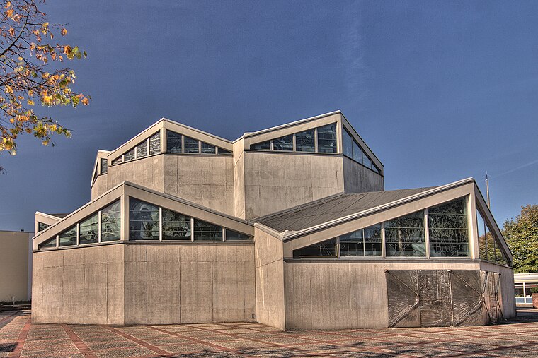
Düsseldorf-Garath station
Railway stop

Photo: A.Savin, CC BY-SA 3.0.
Düsseldorf-Garath is a railway station situated at Garath, Düsseldorf in western Germany. It is served by lines S6 and S68 of the Rhine-Ruhr S-Bahn. Düsseldorf-Garath station is situated 190 metres east of Sombat’s.
Dietrich-Bonhoeffer-Kirche
Church
 Dietrich-Bonhoeffer-Kirche is a church, which is situated 380 metres northwest of Sombat’s.
Places in the Area
Nearby places include Düsseldorf-Garath and Hellerhof.
Düsseldorf-Garath
Suburb

Photo: Grkauls, Public domain.
Garath is a suburb of Düsseldorf, Germany, south of the city centre and part of Borough 10. It has an area of 3.26 km2, and 19,048 inhabitants.
Hellerhof
Suburb
Hellerhof is a quarter of the city of Düsseldorf, part of Borough 10. Düsseldorf-Hellerhof is in the far southeast part of Düsseldorf. It connects Düsseldorf with the towns of Langenfeld and Monheim am Rhein.
Düsseldorf-Benrath
Suburb

Photo: Wiegels, CC BY-SA 3.0.
Benrath is a quarter of Düsseldorf in the south of the city, part of Borough 9. It has been a part of Düsseldorf since 1929. Benrath has an area of 5.99 km2, and 17,178 inhabitants. Düsseldorf-Benrath is situated 2½ km northwest of Sombat’s.
Sombat’s
- Type: Massage shop
- Address: Hermann-Ehlers-Straße 2, Düsseldorf, 40595
- Category: shop
- Location: Düsseldorf, Düsseldorf, Lower Rhine, North Rhine-Westphalia, Germany, Central Europe, Europe
- View on OpenStreetMap
Latitude
51.14328° or 51° 8′ 36″ northLongitude
6.89504° or 6° 53′ 42″ eastOpen location code
9F384VVW+82OpenStreetMap ID
node 6037407287OpenStreetMap feature
shop=massage
This page is based on OpenStreetMap, Wikidata, and Wikimedia Commons.
We’d love your help improving our open data sources. Thank you for contributing.
Satellite Map
Discover Sombat’s from above in high-definition satellite imagery.
Notable Places Nearby
Highlights include Kurt-Schumacher-Straße and Heinrich-von-Brentano-Platz.
Nearby Places
Explore places such as O2 and Goldschmiede Lipiec.
Lower Rhine: Must-Visit Destinations
Delve into Mönchengladbach, Krefeld, Neuss, and Kleve.
Curious Massage Shops to Discover
Uncover intriguing massage shops from every corner of the globe.
About Mapcarta. Data © OpenStreetMap contributors and available under the Open Database License". Text is available under the CC BY-SA 4.0 license, except for photos, directions, and the map. Photo: Steff, CC BY-SA 3.0.