El Cani
El Cani is a picnic site in Fuente de Cantos, Badajoz, Extremadura. El Cani is situated nearby to Plaza del Padre Manjon, as well as near the park Parque Nicolás Megía.| Tap on a place to explore it |
Places in the Area
Nearby places include Calzadilla de los Barros and Bienvenida.
Calzadilla de los Barros
Village
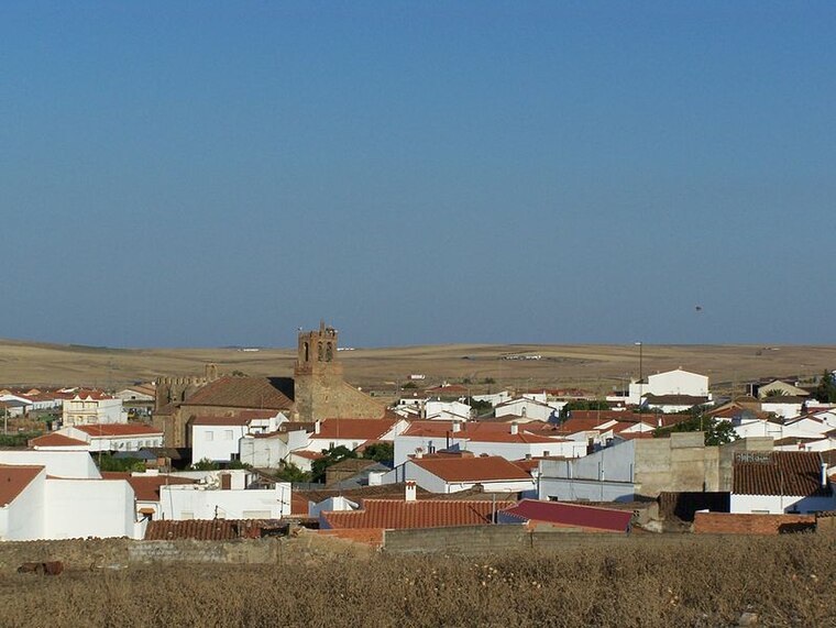
Photo: Spanishperson, Public domain.
Calzadilla de los Barros is a municipality located in the province of Badajoz, Extremadura, Spain. According to the 2005 census, the municipality has a population of 1174 inhabitants. Calzadilla de los Barros is situated 7 km north of El Cani.
Bienvenida
Village
 Bienvenida is a Spanish municipality in the province of Badajoz, Extremadura. It has a population of 2,343 and an area of 92.2 km². It is the Spanish town that is a member of the Charter of European Rural Communities, a town twinning association across the European Union. Bienvenida is situated 10 km northeast of El Cani.
El Cani
- Type: Picnic site
- Category: tourism
- Location: Fuente de Cantos, Badajoz, Extremadura, Central Spain, Spain, Iberia, Europe
- View on OpenStreetMap
Latitude
38.24399° or 38° 14′ 38″ northLongitude
-6.30034° or 6° 18′ 1″ westOpen location code
8CCM6MVX+HVOpenStreetMap ID
node 6099080510OpenStreetMap feature
tourism=picnic_site
This page is based on OpenStreetMap, Wikidata, and Wikimedia Commons.
We’d love your help improving our open data sources. Thank you for contributing.
Satellite Map
Discover El Cani from above in high-definition satellite imagery.
Notable Places Nearby
Highlights include Parque del Cani and Zona el Ferial.
Nearby Places
Explore places such as Tanatorio-Funeraria NTRA. SRA DE LA HERMOSA and Instituto de Educación Secundaria Alba Plata.
Extremadura: Must-Visit Destinations
Delve into Mérida, Badajoz, Caceres, and Plasencia.
Curious Picnic Sites to Discover
Uncover intriguing picnic sites from every corner of the globe.
About Mapcarta. Data © OpenStreetMap contributors and available under the Open Database License". Text is available under the CC BY-SA 4.0 license, except for photos, directions, and the map. Photo: LBM1948, CC BY 4.0.