Pascy de Charneux
Pascy de Charneux is a locality in Jalhay, Arrondissement of Verviers, Wallonia. Pascy de Charneux is situated nearby to the locality Trillepoille, as well as near Devant Moreheid.| Tap on a place to explore it |
Places of Interest
Highlights include Lake Gileppe.
Lake Gileppe
Reservoir
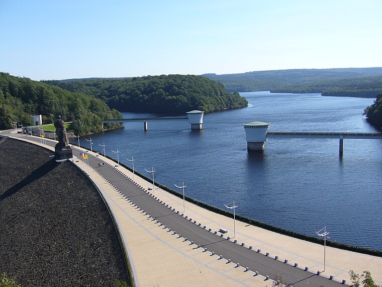
Photo: Alan4630, CC BY-SA 2.5.
Lake Gileppe is located in Wallonia, in the east of Belgium, near the city of Verviers. There is a 78 m high panoramic tower with a restaurant on the top to look at the lake and the landscape. The water volume is 26,400,000 m³ and the area is 1,3 km2. Lake Gileppe is situated 3½ km northeast of Pascy de Charneux.
Places in the Area
Nearby places include Solwaster and Sart-lez-Spa.

Sart-lez-Spa
Village

Photo: Accrochoc, CC BY-SA 3.0.
Sart-lez-Spa is a village of Wallonia and a district of the municipality of Jalhay, located in the province of Liège, Belgium. Nearby is the river Hoëgne, a tributary of the river Vesdre. Sart-lez-Spa is situated 4½ km southwest of Pascy de Charneux.
Halloux
Village

Photo: Michielverbeek, CC BY-SA 4.0.
Halloux is a village, which is situated 6 km north of Pascy de Charneux.
Pascy de Charneux
- Type: Locality
- Location: Jalhay, Arrondissement of Verviers, Liège, Wallonia, Belgium, Benelux, Europe
- View on OpenStreetMap
Latitude
50.55412° or 50° 33′ 15″ northLongitude
5.96394° or 5° 57′ 50″ eastOpen location code
9F27HX37+JHOpenStreetMap ID
node 6149407528OpenStreetMap feature
place=locality
This page is based on OpenStreetMap, Wikidata, and Wikimedia Commons.
We’d love your help improving our open data sources. Thank you for contributing.
Satellite Map
Discover Pascy de Charneux from above in high-definition satellite imagery.
Localities in the Area
Explore places such as Trillepoille and Devant Moreheid.
Notable Places Nearby
Highlights include Église Saint-Michel and Administration Communale de Jalhay.
Curious Localities to Discover
Uncover intriguing localities from every corner of the globe.
About Mapcarta. Data © OpenStreetMap contributors and available under the Open Database License". Text is available under the CC BY-SA 4.0 license, except for photos, directions, and the map. Photo: Paul Hermans, CC BY-SA 3.0.