Starosielce PKP/Pętla
Starosielce PKP/Pętla is a bus stop in Białystok, Podlaskie. Starosielce PKP/Pętla is situated nearby to the railway station Białystok Starosielce train station, as well as near Park Janiny Kurkowskiej-Spychajowej.| Tap on a place to explore it |
Places of Interest Nearby
Highlights include Białystok Starosielce train station and Saint Andrew Bobola church in Białystok.
Białystok Starosielce train station
Railway station

Photo: Maliniak, CC BY-SA 2.5.
Białystok Starosielce train station is a railway station.
Saint Andrew Bobola church in Białystok
Church
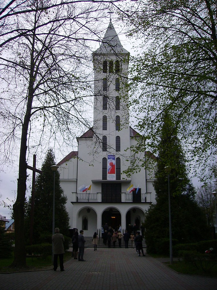
Photo: Henryk Borawski, CC BY 3.0.
Saint Andrew Bobola church in Białystok is situated 650 metres north of Starosielce PKP/Pętla.
Orthodox church of the Dormition in Białystok-Starosielce
Church

Photo: Loraine, CC BY-SA 3.0.
Orthodox church of the Dormition in Białystok-Starosielce is situated 660 metres west of Starosielce PKP/Pętla.
Places in the Area
Nearby places include Osiedle Starosielce and Sikorszczyzna.
Osiedle Starosielce
Suburb
Starosielce is a district of Białystok, Poland, located in the western part of the city.
Sikorszczyzna
Hamlet
Sikorszczyzna is a village in the administrative district of Gmina Choroszcz, within Białystok County, Podlaskie Voivodeship, in north-eastern Poland.
Klepacze
Village

Photo: Athantor, CC BY-SA 3.0.
Klepacze is a village in the administrative district of Gmina Choroszcz, within Białystok County, Podlaskie Voivodeship, in north-eastern Poland. The village is considered part of Metropolitan Białystok in order to help economically develop the region.
Starosielce PKP/Pętla
- Type: Bus stop
- Category: transportation
- Location: Białystok, Podlaskie, Poland, Central Europe, Europe
- View on OpenStreetMap
Latitude
53.12189° or 53° 7′ 19″ northLongitude
23.08652° or 23° 5′ 12″ eastNetwork
Buses in BiałystokOpen location code
9G5543CP+QJOpenStreetMap ID
node 6169273758OpenStreetMap feature
highway=bus_stopOpenStreetMap feature
public_transport=platform
This page is based on OpenStreetMap, Wikidata, and Wikimedia Commons.
We’d love your help improving our open data sources. Thank you for contributing.
Satellite Map
Discover Starosielce PKP/Pętla from above in high-definition satellite imagery.
Notable Places Nearby
Highlights include Park Janiny Kurkowskiej-Spychajowej and Kościół pw. Najświętszej Maryi Panny z Gwadelupe.
Nearby Places
Explore places such as Starosielce PKP/Pętla and Starosielce PKP/Pętla.
Podlaskie: Must-Visit Destinations
Delve into Suwałki, Augustów, Białowieża National Park, and Sejny.
Curious Bus Stops to Discover
Uncover intriguing bus stops from every corner of the globe.
About Mapcarta. Data © OpenStreetMap contributors and available under the Open Database License". Text is available under the CC BY-SA 4.0 license, except for photos, directions, and the map. Photo: Magkrys, CC BY-SA 3.0.