Mike Thorpe Windows
Mike Thorpe Windows is a shop in York, England which is located on Boroughbridge Road. Mike Thorpe Windows is situated nearby to Acomb Fire Station, as well as near Poppleton Road Primary School.| Tap on a place to explore it |
- Type: Shop
- Also known as: “Dock’s Trading Post”
- Address: 23 Boroughbridge Road, York, YO26 5RT
Places of Interest Nearby
Highlights include York Cold War Bunker and Holy Redeemer Church, York.
York Cold War Bunker

Photo: Mike Peel, CC BY-SA 4.0.
The York Cold War Bunker is a two-storey, semi-subterranean, Cold War bunker in the Holgate area of York, England, built in 1961 to monitor nuclear explosions and fallout in Yorkshire, in the event of nuclear war. York Cold War Bunker is situated 2,400 feet south of Mike Thorpe Windows.
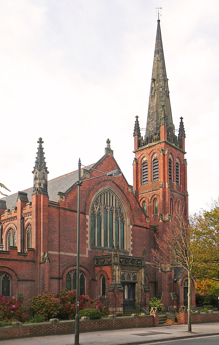
Holy Redeemer Church, York
Church

Photo: Warofdreams, CC BY-SA 4.0.
The Holy Redeemer Church lies on Boroughbridge Road, in the Acomb area of York, in England. The first church here was a simple brick building, completed in 1938. Holy Redeemer Church, York is situated 1,800 feet northwest of Mike Thorpe Windows.
Holgate Windmill

Photo: Synaptic peach, CC BY-SA 3.0.
Holgate Windmill is a tower mill at Holgate in York, North Yorkshire, England which has been restored to working order. Holgate Windmill is situated 2,900 feet southeast of Mike Thorpe Windows.
Places in the Area
Nearby places include Holgate and Acomb.
Holgate
Suburb
Holgate is a suburb of York in the ceremonial county of North Yorkshire, England. It is located about 1 mile west of Micklegate Bar in the city walls. Holgate is also the name of an electoral ward in the City of York unitary authority.
Acomb
Suburb

Photo: Wikimedia, CC BY-SA 2.0.
Acomb, is a village and suburb within the City of York unitary authority area, in North Yorkshire, England, to the western side of York. It covers the site of the original village of the same name, which is mentioned in the Domesday Book of 1086.
Clifton
Suburb
 Clifton is a suburb of York in the unitary authority area of the City of York, in North Yorkshire, England about 1+1⁄2 miles from the city centre. The A19, passes north out of York through Clifton.
Mike Thorpe Windows
- Location: York, England, United Kingdom, Britain and Ireland, Europe
- View on OpenStreetMap
Latitude
53.96325° or 53° 57′ 48″ northLongitude
-1.11757° or 1° 7′ 3″ westOpen location code
9C5WXV7J+8XOpenStreetMap ID
node 6169652808OpenStreetMap feature
shop=windows
This page is based on OpenStreetMap, Wikidata, and Wikimedia Commons.
We’d love your help improving our open data sources. Thank you for contributing.
Satellite Map
Discover Mike Thorpe Windows from above in high-definition satellite imagery.
Notable Places Nearby
Highlights include Acomb Fire Station and Poppleton Road Primary School.
Nearby Places
Explore places such as The One Stop Shop and Ozzys and Firat.
England: Must-Visit Destinations
Delve into London, Manchester, Sheffield, and Leeds.
Curious Shops to Discover
Uncover intriguing shops from every corner of the globe.
About Mapcarta. Data © OpenStreetMap contributors and available under the Open Database License". Text is available under the CC BY-SA 4.0 license, except for photos, directions, and the map. Photo: sidibousaid, CC BY 2.0.