Tuplin Park
Tuplin Park is a locality in Kingsteignton, Teignbridge District, England. Tuplin Park is situated nearby to the locality Kingsteignton Business Park, as well as near Old Channel.| Tap on a place to explore it |
Places of Interest
Highlights include Newton Abbot Racecourse and Newton Abbot railway station.
Newton Abbot Racecourse

Photo: jeff collins, CC BY-SA 2.0.
Newton Abbot Racecourse is a thoroughbred horse racing venue located on the north bank of the River Teign in the parishes of Kingsteignton and Teigngrace just north of Newton Abbot, Devon, England.
Newton Abbot railway station
Railway station
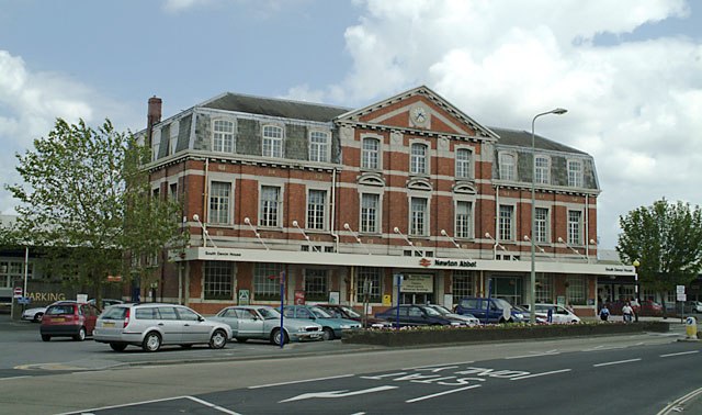
Photo: Mike Crowe, CC BY-SA 2.0.
Newton Abbot railway station serves the market town of Newton Abbot in Devon, England. It is 214 miles 5 chains from London Paddington. The station today is managed by Great Western Railway, who provide train services along with CrossCountry.

Places in the Area
Nearby places include Kingsteignton and Newton Abbot.
Kingsteignton
Town

Photo: Richard Knights, CC BY-SA 2.0.
Kingsteignton, is a town and civil parish in south Devon, England. It lies at the head of the Teign Estuary to the west of Teignmouth in the Teignbridge district.
Newton Abbot

Photo: Lobsterthermidor, Public domain.
Newton Abbot is a market town in the English Riviera and South Devon region of Devon. It runs alongside the River Teign, and has a population of about 26,000 in 2010.
Milber
Suburb

Photo: Paul Hutchinson, CC BY-SA 2.0.
Milber is a suburban area of Newton Abbot and former civil parish, now in the parish of Newton Abbot, in the Teignbridge district of Devon, England. Much of the area comprises a housing estate at grid reference SX8770.
Tuplin Park
- Type: Locality
- Location: Kingsteignton, Teignbridge District, Devon, West Country, England, United Kingdom, Britain and Ireland, Europe
- View on OpenStreetMap
Latitude
50.54234° or 50° 32′ 32″ northLongitude
-3.59523° or 3° 35′ 43″ westOpen location code
9C2RGCR3+WWOpenStreetMap ID
node 619178211OpenStreetMap feature
place=locality
This page is based on OpenStreetMap, Wikidata, and Wikimedia Commons.
We’d love your help improving our open data sources. Thank you for contributing.
Satellite Map
Discover Tuplin Park from above in high-definition satellite imagery.
Localities in the Area
Explore places such as Kingsteignton Business Park and Old Channel.
Notable Places Nearby
Highlights include St Michaels Church and Mama Centre.
Devon: Must-Visit Destinations
Delve into Plymouth, Exeter, Torquay, and Barnstaple.
Curious Localities to Discover
Uncover intriguing localities from every corner of the globe.
About Mapcarta. Data © OpenStreetMap contributors and available under the Open Database License". Text is available under the CC BY-SA 4.0 license, except for photos, directions, and the map. Photo: matthewhartley369, CC BY-SA 2.0.