Emergenza Freddo
Emergenza Freddo is a social service facility in Bolzano/Bozen, South Tyrol, Trentino-Alto Adige which is located on Via Ludwig Von Comini - Ludwig-Von-Comini-Straße. Emergenza Freddo is situated nearby to the bridge Ponte Resia - Reschenbrücke, as well as near the post office Poste Italiane.| Tap on a place to explore it |
Places of Interest Nearby
Highlights include Sparkasse Arena and Bolzano Sud/Bozen Süd railway station.
Sparkasse Arena
Stadium

Photo: Boboseiptu, CC BY 2.5.
The Sparkasse Arena, formerly called PalaOnda or Eiswelle, is an indoor sports arena in Bolzano, Italy. It was built to host the 1994 Men's World Ice Hockey Championships along with Forum di Assago and has a capacity of 7,200. Sparkasse Arena is situated 1 km south of Emergenza Freddo.
Bolzano Sud/Bozen Süd railway station
Railway stop

Photo: Skafa, CC BY-SA 3.0.
Bolzano Sud/Bozen Süd railway station is a railway stop, which is situated 720 metres south of Emergenza Freddo.
Haselburg
Castle
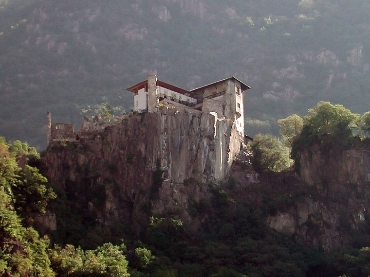
Photo: Cepaea, CC BY-SA 3.0.
Haselburg is a castle, which is situated 1¼ km east of Emergenza Freddo.
Places in the Area
Nearby places include San Giacomo and Gries-Quirein.

Gries-Quirein
Suburb

Photo: Vollmond11, CC BY-SA 3.0.
Gries-Quirein is a suburb, which is situated 2½ km north of Emergenza Freddo.
Bolzano

Photo: Italo-Europeo, CC BY-SA 3.0.
Bolzano or Bozen, is the capital city of South Tyrol, the German-speaking region in the northern part of Italy. Bolzano is the largest city in the region.
Emergenza Freddo
- Type: Social service facility
- Address: Via Ludwig Von Comini - Ludwig-Von-Comini-Straße 16, Bolzano - Bozen, 39100
- Location: Bolzano/Bozen, South Tyrol, Trentino-Alto Adige, Northeast Italy, Italy, Europe
- View on OpenStreetMap
Latitude
46.48° or 46° 28′ 48″ northLongitude
11.32697° or 11° 19′ 37″ eastOpen location code
8FRHF8JG+2QOpenStreetMap ID
node 6193356712OpenStreetMap feature
amenity=social_facility
This page is based on OpenStreetMap, Wikidata, and Wikimedia Commons.
We’d love your help improving our open data sources. Thank you for contributing.
Satellite Map
Discover Emergenza Freddo from above in high-definition satellite imagery.
Notable Places Nearby
Highlights include Ponte Resia - Reschenbrücke and Poste Italiane.
Nearby Places
Explore places such as Via Torricelli - Torricellistraße and J. Lemayr.
South Tyrol: Must-Visit Destinations
Delve into Bolzano, Brixen, Merano, and Bruneck.
Curious Social Service Facilities to Discover
Uncover intriguing social service facilities from every corner of the globe.
About Mapcarta. Data © OpenStreetMap contributors and available under the Open Database License". Text is available under the CC BY-SA 4.0 license, except for photos, directions, and the map. Photo: Benreis, CC BY 3.0.