Shilander Collision
Shilander Collision is an automobile repair shop in City of Ludington, Mason, Michigan. Shilander Collision is situated nearby to the marketplace The 10 Spot, as well as near Spectrum Health Ludington Hospital.| Tap on a place to explore it |
Places of Interest Nearby
Highlights include Mason County Courthouse and Mason County Airport.
Mason County Courthouse
Courthouse

Photo: Doug Coldwell, CC BY-SA 3.0.
Mason County Courthouse is situated 1 mile west of Shilander Collision.
Mason County Airport
Aerodrome
Mason County Airport is a county-owned public-use airport located two miles northeast of the central business district of Ludington, a city in Mason County, Michigan, United States.
Ludington Light
Lighthouse
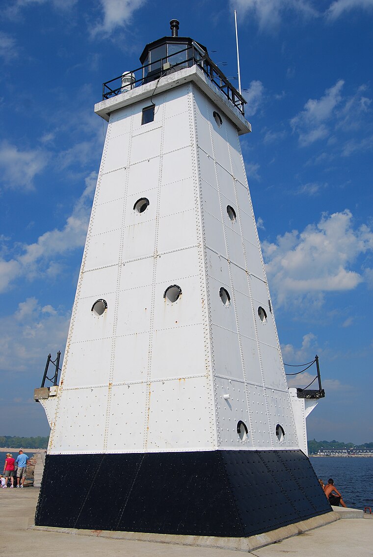
Photo: Parkerdr, CC BY-SA 3.0.
The Ludington Light is a 57-foot tall steel-plated lighthouse in Ludington, Michigan, which lies along the eastern shores of Lake Michigan, at the end of the breakwater on the Pere Marquette Harbor. Ludington Light is situated 2 miles west of Shilander Collision.
Places in the Area
Nearby places include Ludington and Buttersville.
Ludington

Photo: Doug Coldwell, CC BY-SA 3.0.
Ludington is a city in the U.S. state of Michigan. It is the county seat and the largest city in Mason County. The population was 7,655 at the 2020 census, making it the fourth largest city in the northern Michigan area.
Buttersville
Hamlet
Buttersville, Michigan was a village in Mason County, Michigan near Ludington. It was established in 1880 as a company town serving the Butters & Peters sawmill. Buttersville is situated 1½ miles southwest of Shilander Collision.
Shilander Collision
- Type: Automobile repair shop
- Categories: shop and transportation
- Location: City of Ludington, Mason, Michigan, Midwest, United States, North America
- View on OpenStreetMap
Latitude
43.9554° or 43° 57′ 19″ northLongitude
-86.42742° or 86° 25′ 39″ westOpen location code
86MMXH4F+52OpenStreetMap ID
node 6219705529OpenStreetMap feature
shop=car_repair
This page is based on OpenStreetMap, Wikidata, and Wikimedia Commons.
We’d love your help improving our open data sources. Thank you for contributing.
Satellite Map
Discover Shilander Collision from above in high-definition satellite imagery.
Notable Places Nearby
Highlights include Spectrum Health Ludington Hospital and The 10 Spot.
Nearby Places
Explore places such as Performance Plus Quick Lube and Synergy Broadcast Group.
Michigan: Must-Visit Destinations
Delve into Detroit, Ann Arbor, Lansing, and Grand Rapids.
Curious Automobile Repair Shops to Discover
Uncover intriguing automobile repair shops from every corner of the globe.
About Mapcarta. Data © OpenStreetMap contributors and available under the Open Database License". Text is available under the CC BY-SA 4.0 license, except for photos, directions, and the map. Photo: Wikimedia, CC0.