Centro Familiar de Salud
Centro Familiar de Salud is in Madrid, Community of Madrid. Centro Familiar de Salud is situated nearby to the metro station Peñagrande, as well as near the health club Palomares.| Tap on a place to explore it |
Places of Interest Nearby
Highlights include Peñagrande and Avenida de la Ilustración.
Peñagrande
Metro station

Photo: Draceane, CC BY-SA 4.0.
Peñagrande is a station on Line 7 of the Madrid Metro, serving the barrio of Peñagrande. It is located in fare Zone A.
Avenida de la Ilustración
Metro station

Photo: Draceane, CC BY-SA 4.0.
Avenida de la Ilustración is a station on Line 7 of the Madrid Metro, on the Avenida de la Ilustración. It is located in fare Zone A. Avenida de la Ilustración is situated 530 metres northwest of Centro Familiar de Salud.
Antonio Machado
Metro station
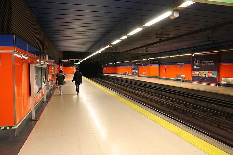
Photo: Draceane, CC BY-SA 4.0.
Antonio Machado is a station on Line 7 of the Madrid Metro, near the Calle de Antonio Machado. It is located in fare Zone A. This station close to the street of the same name, in the Valdezarza neighborhood. Antonio Machado is situated 650 metres south of Centro Familiar de Salud.
Places in the Area
Nearby places include El Pilar and Peñagrande.
El Pilar
Quarter

Photo: Ricardo Ricote Rodrí…, CC BY 3.0.
El Pilar is a ward of Madrid, the capital of Spain, belonging to the district of Fuencarral-El Pardo.
Peñagrande
Quarter

Photo: Asqueladd, CC BY-SA 3.0.
Peñagrande is a neighborhood to the north of Madrid's city centre, in the district of Fuencarral-El Pardo. Peñagrande is Madrid's 26th largest neighborhood in terms of land area, its 10th largest in population and 77th largest in population density.
Valdezarza
Quarter

Photo: Malopez 21, CC BY-SA 4.0.
Valdezarza is an administrative neighborhood of Madrid belonging to the district of Moncloa-Aravaca.
Centro Familiar de Salud
- Type: Health care
- Location: Madrid, Madrid, Community of Madrid, Central Spain, Spain, Iberia, Europe
- View on OpenStreetMap
Latitude
40.47574° or 40° 28′ 33″ northLongitude
-3.71564° or 3° 42′ 56″ westOpen location code
8CGRF7GM+7POpenStreetMap ID
node 6235716491OpenStreetMap feature
healthcare=yes
This page is based on OpenStreetMap, Wikidata, and Wikimedia Commons.
We’d love your help improving our open data sources. Thank you for contributing.
Satellite Map
Discover Centro Familiar de Salud from above in high-definition satellite imagery.
Notable Places Nearby
Highlights include Palomares and Bodegas Sanz.
Nearby Places
Explore places such as Robledo and Pilar Dolado.
Madrid: Must-Visit Destinations
Delve into Sol-Letras-Lavapiés, Salamanca, Retiro-Paseo del Arte, and Chamberí-Castellana.
Curious Places to Discover
Uncover intriguing places from every corner of the globe.
About Mapcarta. Data © OpenStreetMap contributors and available under the Open Database License". Text is available under the CC BY-SA 4.0 license, except for photos, directions, and the map. Photo: DonPaolo, CC BY-SA 3.0.