Opp Ashburnham Road
Opp Ashburnham Road is a bus stop in Hastings District, East Sussex, England. Opp Ashburnham Road is situated nearby to the church The Salvation Army, as well as near the nature reserve Speckled Wood.| Tap on a place to explore it |
Places of Interest Nearby
Highlights include Speckled Wood and Christ Church, Ore.
Speckled Wood
Nature reserve

Photo: FOSWMT, CC BY-SA 3.0.
Speckled Wood is a 12.7-acre woodland and park in Ore Village in the Ore Valley, Hastings, East Sussex, United Kingdom. The woodland park consists of woodland trails and clearings.
Christ Church, Ore
Church

Photo: The Voice of Hassocks, Public domain.
Christ Church is an Anglican church in the Ore area of the town and borough of Hastings, one of six local government districts in the English county of East Sussex. Christ Church, Ore is situated 1,100 feet northeast of Opp Ashburnham Road.
All Souls Church
Church
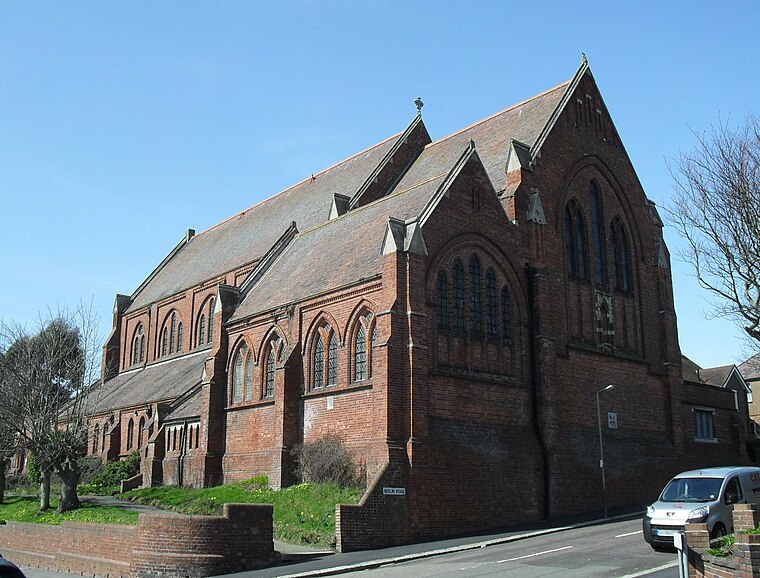
Photo: The Voice of Hassocks, Public domain.
All Souls Church is a former Anglican church that served the Clive Vale suburb of Hastings, a seaside resort town and borough in the English county of East Sussex, between 1890 and 2007. All Souls Church is situated 1,200 feet southeast of Opp Ashburnham Road.
Places in the Area
Nearby places include Ore and Belmont.
Ore
Suburb

Photo: Sandpiper, Public domain.
Ore is a large suburb of the urban area of Hastings, in the Hastings district, in the county of East Sussex, England. Formerly a village, it is still known and advertised locally as "Ore Village".
Belmont
Suburb
Belmont is a suburb of Hastings in East Sussex, England. The village falls within the Borough of Hastings.
Hastings

Photo: Natataek, CC BY-SA 4.0.
Hastings is a seaside town in East Sussex in southeast England. It's run down, but has budget accommodation and several sites of interest. Hastings is most famous for the battle that took place there in 1066 between King Harold's English and William the Conqueror's Normans.
Opp Ashburnham Road
- Type: Bus stop
- Category: transportation
- Location: Hastings District, East Sussex, South East England, England, United Kingdom, Britain and Ireland, Europe
- View on OpenStreetMap
Latitude
50.87021° or 50° 52′ 13″ northLongitude
0.60443° or 0° 36′ 16″ eastOpen location code
9F22VJC3+3QOpenStreetMap ID
node 6237273588OpenStreetMap feature
highway=bus_stopOpenStreetMap feature
public_transport=platform
This page is based on OpenStreetMap, Wikidata, and Wikimedia Commons.
We’d love your help improving our open data sources. Thank you for contributing.
Satellite Map
Discover Opp Ashburnham Road from above in high-definition satellite imagery.
Notable Places Nearby
Highlights include The Salvation Army and St Helen’s Hospital Gatepost.
Nearby Places
Explore places such as The Community Shop and School Road Substation.
East Sussex: Must-Visit Destinations
Delve into Brighton, Eastbourne, Hastings, and Lewes.
Curious Bus Stops to Discover
Uncover intriguing bus stops from every corner of the globe.
About Mapcarta. Data © OpenStreetMap contributors and available under the Open Database License". Text is available under the CC BY-SA 4.0 license, except for photos, directions, and the map. Photo: matthewhartley369, CC BY-SA 2.0.