The New Kings
The New Kings is a pub in County Durham, North East England, England which is located on Hope Street. The New Kings is situated nearby to the public building Civic Centre, as well as near Crook Library.| Tap on a place to explore it |
- Type: Pub
- Also known as: “The Kings”
- Address: 69 Hope Street, Crook, DL15 9HT
Places of Interest Nearby
Highlights include Harperley POW Camp 93 and Fir Tree War Memorial Drinking Fountain.
Harperley POW Camp 93
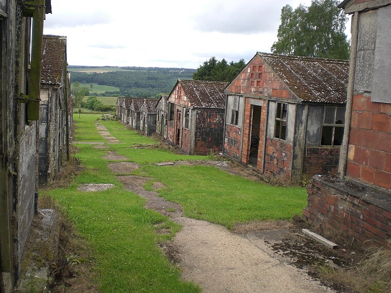
Photo: Rolyat29, CC BY-SA 3.0.
Harperley POW Camp 93 is a surviving purpose-built World War II Prisoner of War camp built to accommodate up to 1,400 inmates at Fir Tree near Crook, County Durham in the northeast of England. Harperley POW Camp 93 is situated 2½ miles west of The New Kings.
Fir Tree War Memorial Drinking Fountain
Memorial
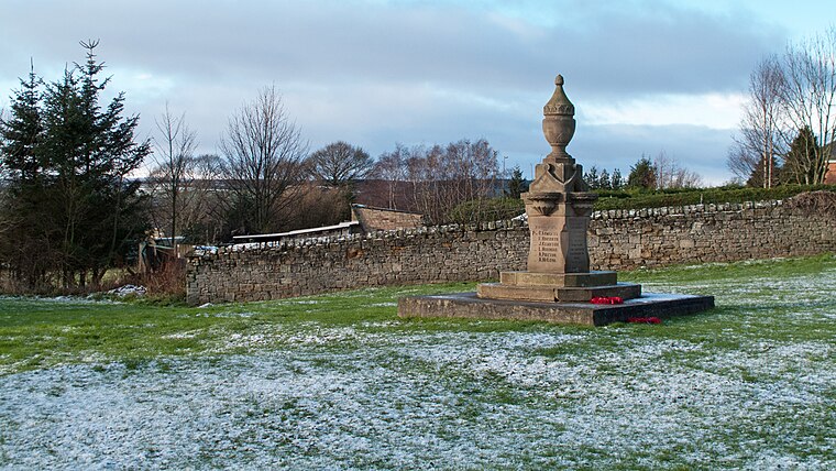
Photo: Trevor Littlewood, CC BY-SA 2.0.
Fir Tree War Memorial Drinking Fountain is situated 1½ miles southwest of The New Kings.
Parkside Academy
School
Parkside Academy, is a coeducational secondary school with academy status, located in Hall Lane Estate, Willington, Crook, County Durham, England. Parkside teaches a wide range of standard, and specialist curriculum subjects as well as a multitude of after school activities. Parkside Academy is situated 2½ miles east of The New Kings.
Places in the Area
Nearby places include Crook and Roddymoor.
Crook
Town
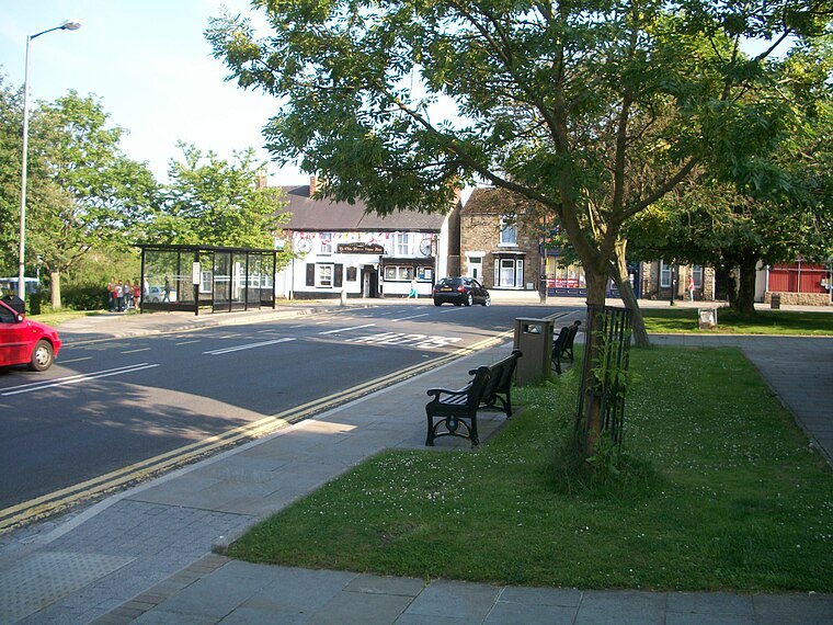
Photo: Walkerma, CC BY-SA 3.0.
Crook is a market town in the Durham County Council unitary authority and ceremonial county of County Durham, England. It is located on the edge of Weardale and sometimes referred to as the "Gateway to Weardale".
Roddymoor
Village
Roddymoor is a village in County Durham, in England. In the 2001 census Roddymoor had a population of 500.
Billy Row
Village

Photo: Oliver Dixon, CC BY-SA 2.0.
Billy Row is a village in County Durham, England. It is situated a short distance to the north of Crook. According to the 2001 census Billy Row has a population of 824.
The New Kings
Latitude
54.71574° or 54° 42′ 57″ northLongitude
-1.74667° or 1° 44′ 48″ westOpen location code
9C6WP783+78OpenStreetMap ID
node 6240381259OpenStreetMap feature
amenity=pub
This page is based on OpenStreetMap, Wikidata, and Wikimedia Commons.
We’d love your help improving our open data sources. Thank you for contributing.
Satellite Map
Discover The New Kings from above in high-definition satellite imagery.
Places with the Same Name
Discover other places named “The New Kings”.
Notable Places Nearby
Highlights include Civic Centre and Crook Library.
Nearby Places
Explore places such as Gallarie and Betfred.
County Durham: Must-Visit Destinations
Delve into Durham, Darlington, Hartlepool, and Stockton-on-Tees.
Curious Pubs to Discover
Uncover intriguing pubs from every corner of the globe.
About Mapcarta. Data © OpenStreetMap contributors and available under the Open Database License". Text is available under the CC BY-SA 4.0 license, except for photos, directions, and the map. Photo: Roberto Strauss, CC BY 2.0.