Cindys Bakery - Bauang
Cindys Bakery - Bauang is a pâtisserie in La Union, Ilocos. Cindys Bakery - Bauang is situated nearby to the police station P.O.S.T.E., as well as near Seventh Day Adventist Church.| Tap on a place to explore it |
Places in the Area
Nearby places include Bauang and Naguilian.
Bauang
Town

Photo: Ramon FVelasquez, CC BY-SA 3.0.
Bauang, officially the Municipality of Bauang, is a municipality in the province of La Union, Philippines. According to the 2020 census, it has a population of 78,449.
Naguilian
Town

Photo: Judgefloro, Public domain.
Naguilian, officially the Municipality of Naguilian, is a municipality in the province of La Union, Philippines, According to the 2020 census, it has a population of 52,189 people. Naguilian is situated 7 km east of Cindys Bakery - Bauang.
San Fernando
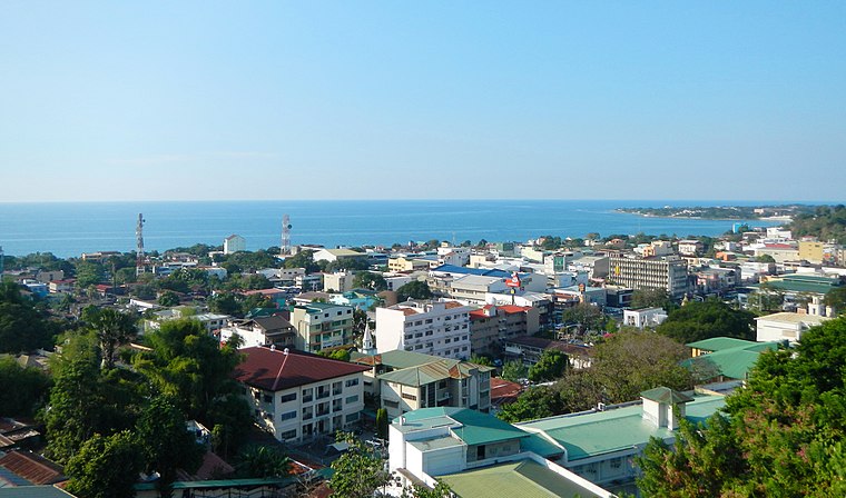
Photo: Ramon FVelaquez, CC BY-SA 3.0.
San Fernando is a city, the capital of the province of La Union in the Philippines. It is sometimes referred to with the initials of La Union's name, L.U, to distinguish it from the capital city of Pampanga of the same name.
Cindys Bakery - Bauang
- Type: Pâtisserie
- Categories: shop and food
- Location: La Union, Ilocos, Luzon, Philippines, Southeast Asia, Asia
- View on OpenStreetMap
Latitude
16.52957° or 16° 31′ 46″ northLongitude
120.32959° or 120° 19′ 47″ eastOpen location code
7Q82G8HH+RROpenStreetMap ID
node 6248624598OpenStreetMap feature
shop=pastry
This page is based on OpenStreetMap, Wikidata, and Wikimedia Commons.
We’d love your help improving our open data sources. Thank you for contributing.
Satellite Map
Discover Cindys Bakery - Bauang from above in high-definition satellite imagery.
Notable Places Nearby
Highlights include P.O.S.T.E. and Seventh Day Adventist Church.
Nearby Places
Explore places such as Hen Haw Restaurant and L.U. Guani Optical Clinic.
Curious Pâtisseries to Discover
Uncover intriguing pâtisseries from every corner of the globe.
About Mapcarta. Data © OpenStreetMap contributors and available under the Open Database License". Text is available under the CC BY-SA 4.0 license, except for photos, directions, and the map. Photo: Wikimedia, CC0.