Lucky Stop Market
Lucky Stop Market is a convenience store in Alameda, California. Lucky Stop Market is situated nearby to Grace Community Methodist Church, as well as near New Apostolic Church.| Tap on a place to explore it |
Places of Interest Nearby
Highlights include Oakland Zoo and Dunsmuir House.
Oakland Zoo
Zoo
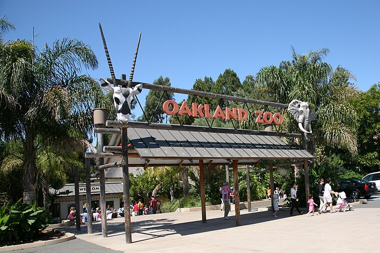
Photo: Wikimedia, CC BY-SA 2.0.
The Oakland Zoo is located in the Grass Valley neighborhood of Oakland, California, United States. Established on June 6, 1922, it is managed by the Conservation Society of California, a 501 non-profit organization dedicated to the conservation of wildlife both locally and globally. Oakland Zoo is situated 4,000 feet northeast of Lucky Stop Market.
Dunsmuir House
Museum
The Dunsmuir House and Gardens is located in Oakland, California on a 50-acre site. The Dunsmuir House has a neoclassical-revival architectural style and is listed in the U.S. National Register of Historic Places. Dunsmuir House is situated 1 mile east of Lucky Stop Market.
Bishop O’Dowd High School
School
Bishop O'Dowd High School is a Catholic, co-educational, college preparatory school in Oakland, California, administered by the Roman Catholic Diocese of Oakland and named after the late auxiliary Bishop of the Archdiocese of San Francisco, James T. Bishop O’Dowd High School is situated 2,700 feet north of Lucky Stop Market.
Places in the Area
Nearby places include Elmhurst and San Leandro.
Elmhurst
Neighborhood
Elmhurst is a residential neighborhood in the southernmost part of Oakland, California. Originally a separate unincorporated town, it was annexed by Oakland in 1909, and today is considered part of East Oakland. It lies at an elevation of 39 feet.
San Leandro

Photo: Wsiegmund, CC BY-SA 3.0.
San Leandro is a mid-size city of about 90,000 people in the San Francisco Bay Area in Northern California in the United States of America.
Brookfield Village
Neighborhood
Brookfield Village is an Oakland, California neighborhood located in East Oakland near Oakland International Airport. The main streets are 98th Avenue and Edes Avenue. Brookfield Village is situated 2 miles southwest of Lucky Stop Market.
Lucky Stop Market
- Type: Convenience store
- Categories: shop and food
- Location: Alameda, California, United States, North America
- View on OpenStreetMap
Latitude
37.74593° or 37° 44′ 45″ northLongitude
-122.15644° or 122° 9′ 23″ westOpen location code
849VPRWV+9COpenStreetMap ID
node 6257278105OpenStreetMap feature
shop=convenience
This page is based on OpenStreetMap, Wikidata, and Wikimedia Commons.
We’d love your help improving our open data sources. Thank you for contributing.
Satellite Map
Discover Lucky Stop Market from above in high-definition satellite imagery.
Notable Places Nearby
Highlights include Grace Community Methodist Church and New Apostolic Church.
Nearby Places
Explore places such as Premier Inn & Suites and MacArthur Boulevard & Byron Avenue.
California: Must-Visit Destinations
Delve into San Francisco, Los Angeles, San Diego, and Sacramento.
Curious Convenience Stores to Discover
Uncover intriguing convenience stores from every corner of the globe.
About Mapcarta. Data © OpenStreetMap contributors and available under the Open Database License". Text is available under the CC BY-SA 4.0 license, except for photos, directions, and the map. Photo: Miskatonic, CC BY 2.5.