Chêne du centenaire (1830-1930)
Chêne du centenaire (1830-1930) is a historic site in Jodoigne, Arrondissement of Nivelles, Wallonia. Chêne du centenaire (1830-1930) is situated nearby to the church Église Saint-Pierre, as well as near the village Jodoigne-Souveraine.| Tap on a place to explore it |
Places of Interest Nearby
Highlights include Former town hall of Jodoigne and Château Pastur.
Former town hall of Jodoigne
Community center

Photo: EmDee, CC BY-SA 3.0.
Former town hall of Jodoigne is a community center, which is situated 2½ km northeast of Chêne du centenaire (1830-1930).
Château Pastur
Town hall

Photo: EmDee, CC BY-SA 3.0.
Château Pastur is a town hall, which is situated 2½ km northeast of Chêne du centenaire (1830-1930).
La Ramée Abbey
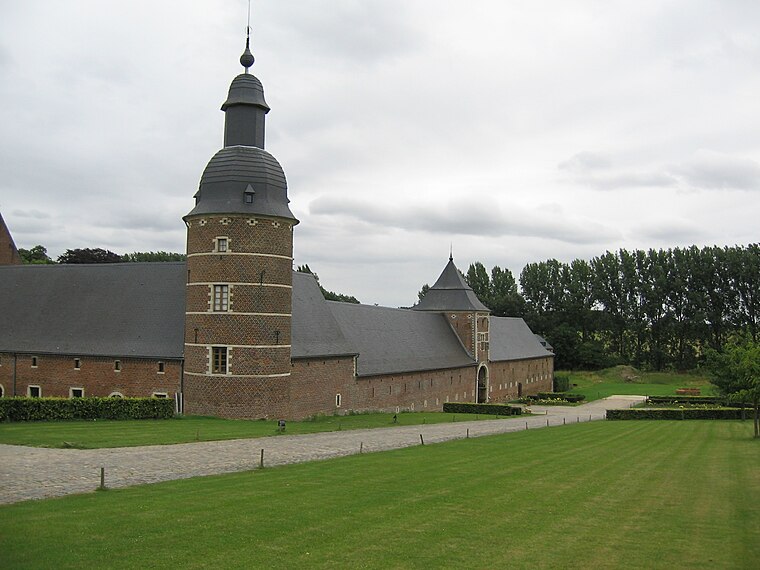
Photo: Grentidez, Public domain.
La Ramée Abbey is situated 3 km south of Chêne du centenaire (1830-1930).
Places in the Area
Nearby places include Jodoigne-Souveraine and Lathuy.
Jodoigne-Souveraine
Village

Photo: Anakil, CC BY-SA 4.0.
Jodoigne-Souveraine is a village of Wallonia and a district of the municipality of Jodoigne, located in the province of Walloon Brabant, Belgium. The village lies next to the Great Gette.
Lathuy
Village
Lathuy is a village of Wallonia and a district of the municipality of Jodoigne, located in the province of Walloon Brabant, Belgium.
Incourt
Village

Photo: Jean-Pol GRANDMONT, CC BY 3.0.
Incourt is a municipality of Wallonia located in the Belgian province of Walloon Brabant. On January 1, 2006, Incourt had a total population of 4,585. The total area is 38.79 km² which gives a population density of 118 inhabitants per km². Incourt is situated 3½ km southwest of Chêne du centenaire (1830-1930).
Chêne du centenaire (1830-1930)
- Type: Historic site
- Categories: tourist attraction and tourism
- Location: Jodoigne, Arrondissement of Nivelles, Walloon Brabant, Wallonia, Belgium, Benelux, Europe
- View on OpenStreetMap
Latitude
50.70779° or 50° 42′ 28″ northLongitude
4.84194° or 4° 50′ 31″ eastOpen location code
9F26PR5R+4QOpenStreetMap ID
node 6298194538OpenStreetMap feature
historic=yesOpenStreetMap feature
natural=tree
This page is based on OpenStreetMap, Wikidata, and Wikimedia Commons.
We’d love your help improving our open data sources. Thank you for contributing.
Satellite Map
Discover Chêne du centenaire (1830-1930) from above in high-definition satellite imagery.
Notable Places Nearby
Highlights include Église Saint-Pierre and Chapelle Notre-Dame de Perpétuel Secours.
Nearby Places
Explore places such as Jacquet and Salle Jacquet.
Walloon Brabant: Must-Visit Destinations
Delve into Waterloo, Villers-la-Ville, and Louvain-la-Neuve.
Curious Historic Sites to Discover
Uncover intriguing historic sites from every corner of the globe.
About Mapcarta. Data © OpenStreetMap contributors and available under the Open Database License". Text is available under the CC BY-SA 4.0 license, except for photos, directions, and the map. Photo: Myrabella, CC BY-SA 3.0.