Borregas station
Borregas station is a light rail station operated by Santa Clara Valley Transportation Authority, located in Sunnyvale, California. This station is served by the Orange Line of the VTA light rail system.| Tap on a place to explore it |
Photo: Pedro Xing, CC0.
- Type: Railway station
- Description: VTA light rail station in Sunnyvale, California
- Also known as: “Borregas”
Places of Interest Nearby
Highlights include Lockheed Martin Transit Center and Crossman station.
Lockheed Martin Transit Center
Railway station

Photo: Grendelkhan, CC BY-SA 3.0.
Lockheed Martin Transit Center is a light rail and transit bus station operated by Santa Clara Valley Transportation Authority, located in Sunnyvale, California. Lockheed Martin Transit Center is situated 2,600 feet west of Borregas station.
Crossman station
Railway station
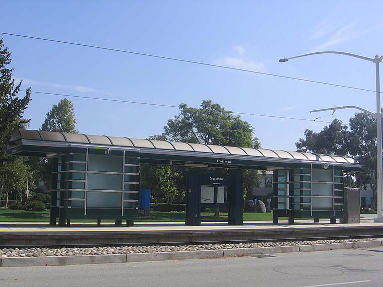
Photo: Pedro Xing, CC0.
Crossman station is a light rail station operated by Santa Clara Valley Transportation Authority, located in Sunnyvale, California. This station is served by the Orange Line of the VTA light rail system. Crossman station is situated 2,200 feet southeast of Borregas station.
Fair Oaks station
Railway station

Photo: Pedro Xing, CC0.
Fair Oaks station is a light rail station operated by Santa Clara Valley Transportation Authority, located in Sunnyvale, California. This station is served by the Orange Line of the VTA light rail system. Fair Oaks station is situated 4,100 feet southeast of Borregas station.
Places in the Area
Nearby places include Alviso and Sunnyvale.
Alviso
Suburb

Photo: Vlad Butsky, CC BY 2.0.
Alviso is a district of San Jose, California, located in North San Jose on the southern shores of San Francisco Bay. Originally an independent town, founded in 1852, today Alviso is San Jose's only waterfront district, primarily residential in nature, with several Silicon Valley tech companies and recreation-oriented businesses. Alviso is situated 2½ miles northeast of Borregas station.
Sunnyvale

Photo: Alexey Komarov, CC BY 3.0.
Sunnyvale is a city in the South Bay region of the San Francisco Bay Area, in California. Sunnyvale was ranked the 5th safest city in the United States in its size category for 2004.
Agnew
Hamlet

Photo: EugeneZelenko, CC BY-SA 4.0.
Agnew's Village was a small unincorporated village in what is now Santa Clara, California. It was named for Abram Agnew, a Santa Clara Valley pioneer from Ohio who settled there around 1873. Agnew is situated 3½ miles east of Borregas station.
Borregas station
- Categories: tram stop, bus station, station, and transportation
- Location: Santa Clara County, California, United States, North America
- View on OpenStreetMap
Latitude
37.41165° or 37° 24′ 42″ northLongitude
-122.01796° or 122° 1′ 5″ westNetwork
VTAOpen location code
849VCX6J+MROpenStreetMap ID
node 6309492420OpenStreetMap feature
amenity=bus_stationOpenStreetMap feature
public_transport=stationOpenStreetMap feature
railway=stationWikidata ID
Q4946563
This page is based on OpenStreetMap, Wikidata, Wikimedia Commons, and Wikipedia.
We’d love your help improving our open data sources. Thank you for contributing.
Satellite Map
Discover Borregas station from above in high-definition satellite imagery.
In Other Languages
“Borregas station” goes by many names.
- French: “Borregas”
Notable Places Nearby
Highlights include United States Postal Service and Humboldt Park.
Nearby Places
Explore places such as East Java Drive & Borregas Avenue and West Java Drive & Borregas Avenue.
California: Must-Visit Destinations
Delve into San Francisco, Los Angeles, San Diego, and Sacramento.
Curious Railway Stations to Discover
Uncover intriguing railway stations from every corner of the globe.
About Mapcarta. Data © OpenStreetMap contributors and available under the Open Database License". Text is available under the CC BY-SA 4.0 license, except for photos, directions, and the map. Description text is based on the Wikipedia page “Borregas station”. Photo: Pedro Xing, CC0.