Imbiss Schlaraffenland
Imbiss Schlaraffenland is a fast food restaurant in Willich, Viersen, North Rhine-Westphalia. Imbiss Schlaraffenland is situated nearby to the playground Doomerstraße, as well as near the sports venue Leonardo-da-Vinci-Gesamtschule-Anrath-1fach Sporthalle.| Tap on a place to explore it |
- Opening hours:
Tuesday—Saturday: 11:30 AM—9:00 PM
public holidays and Sunday: 5:00 PM—9:00 PM
Monday: closed - Type: Fast food restaurant
- Cuisine: international
Places of Interest Nearby
Highlights include Saint John the Baptist Church and Haus Stockum.
Saint John the Baptist Church
Church

Photo: Ichmichi, CC BY-SA 3.0.
Saint John the Baptist Church is situated 470 metres east of Imbiss Schlaraffenland.
Haus Stockum
Castle

Photo: Wikimedia, CC BY-SA 3.0 de.
Haus Stockum is a castle, which is situated 1½ km southwest of Imbiss Schlaraffenland.
Haus Donk
Castle

Photo: Wikimedia, Public domain.
Haus Donk is a castle, which is situated 2½ km northwest of Imbiss Schlaraffenland.
Places in the Area
Nearby places include Anrath and Vennheide.


Neersen
Suburb
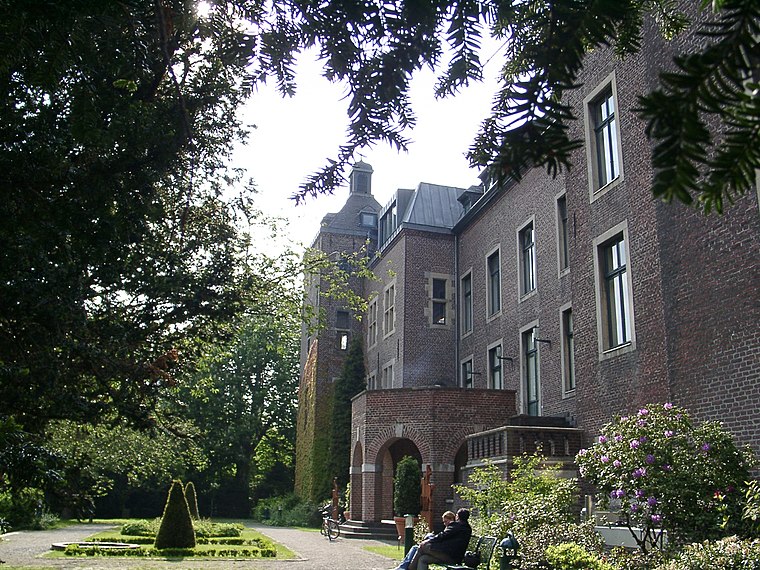
Photo: Historiograf, CC BY 2.0.
Neersen is a suburb, which is situated 3½ km southeast of Imbiss Schlaraffenland.
Imbiss Schlaraffenland
- Categories: food and restaurant
- Location: Willich, Viersen, Düsseldorf, North Rhine-Westphalia, Germany, Central Europe, Europe
- View on OpenStreetMap
Latitude
51.27838° or 51° 16′ 42″ northLongitude
6.45625° or 6° 27′ 23″ eastOpen location code
9F387FH4+9FOpenStreetMap ID
node 6311327105OpenStreetMap feature
amenity=fast_foodOpenStreetMap attribute
cuisine=international
This page is based on OpenStreetMap, Wikidata, and Wikimedia Commons.
We’d love your help improving our open data sources. Thank you for contributing.
Satellite Map
Discover Imbiss Schlaraffenland from above in high-definition satellite imagery.
Notable Places Nearby
Highlights include Doomerstraße and Leonardo-da-Vinci-Gesamtschule-Anrath-1fach Sporthalle.
Nearby Places
Explore places such as Wiesengrund and Caritas-Basar.
North Rhine-Westphalia: Must-Visit Destinations
Delve into Cologne, Düsseldorf, Bonn, and Dortmund.
Curious Fast Food Restaurants to Discover
Uncover intriguing fast food restaurants from every corner of the globe.
About Mapcarta. Data © OpenStreetMap contributors and available under the Open Database License". Text is available under the CC BY-SA 4.0 license, except for photos, directions, and the map. Photo: Daniel Schwen, CC BY-SA 2.5.