Font des Verbol
Font des Verbol is a spring in Sóller, Balearic Islands. Font des Verbol is situated nearby to the spring Font de Can Richard, as well as near Font de Son Ferragut.| Tap on a place to explore it |
Places of Interest Nearby
Highlights include Ferrocarril de Sóller and Puig del Moro.
Ferrocarril de Sóller
Railway station
 The Ferrocarril de Sóller, acronym FS, is an interurban railway and the name for the company which operates the electrified 3 ft narrow-gauge tracks running between the towns of Sóller and Palma on the Spanish island of Mallorca. Ferrocarril de Sóller is situated 3 km southeast of Font des Verbol.

Far del Cap Gros
Lighthouse
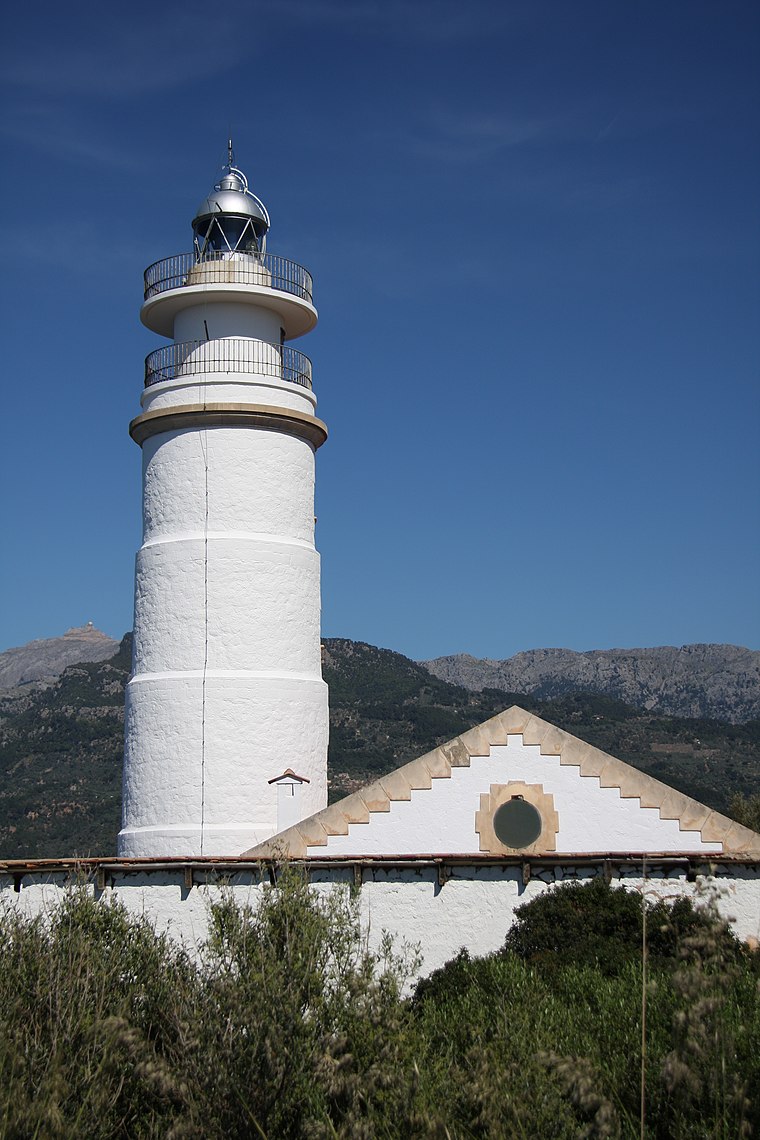
Photo: Wo st 01, CC BY-SA 3.0 de.
Far del Cap Gros is a lighthouse, which is situated 2½ km north of Font des Verbol.
Places in the Area
Nearby places include Port de Sóller and Llucalcari.
Port de Sóller
Village

Photo: BuzzWoof, Public domain.
Port de Sóller is a village and the port of the town of Sóller, in Mallorca, in the Balearic Islands, Spain. Along with the village of Fornalutx and the hamlet of Biniaraix they combine to form Sóller. Port de Sóller is situated 2½ km northeast of Font des Verbol.
Llucalcari
Hamlet

Photo: Wikimedia, CC BY-SA 3.0.
Llucalcari is a hamlet, which is situated 3 km southwest of Font des Verbol.
Deia

Photo: Fr. Diana Korn, CC BY-SA 4.0.
Deià is a village in Serra de Tramuntana on the west coast of Mallorca, with a population in 2024 of 700. It's attractive place in the mountains, best known to English speakers as the final home of Robert Graves.
Font des Verbol
- Type: Spring
- Category: body of water
- Location: Sóller, Balearic Islands, Spain, Iberia, Europe
- View on OpenStreetMap
Latitude
39.77637° or 39° 46′ 35″ northLongitude
2.68299° or 2° 40′ 59″ eastOpen location code
8FF4QMGM+G5OpenStreetMap ID
node 6316488325OpenStreetMap feature
natural=spring
This page is based on OpenStreetMap, Wikidata, and Wikimedia Commons.
We’d love your help improving our open data sources. Thank you for contributing.
Satellite Map
Discover Font des Verbol from above in high-definition satellite imagery.
Notable Places Nearby
Highlights include Font de Can Richard and Font de Son Ferragut.
Nearby Places
Explore places such as ermita del Pare Catany and Corazón.
Balearic Islands: Must-Visit Destinations
Delve into Palma de Mallorca, Formentera, Ibiza, and Maó.
Curious Springs to Discover
Uncover intriguing springs from every corner of the globe.
About Mapcarta. Data © OpenStreetMap contributors and available under the Open Database License". Text is available under the CC BY-SA 4.0 license, except for photos, directions, and the map. Photo: AlasdairW, CC BY-SA 3.0.