Freie evangelische Gemeinde Speyer
Freie evangelische Gemeinde Speyer is a church in Speyer, Palatinate, Rhineland-Palatinate which is located on Raiffeisenstraße. Freie evangelische Gemeinde Speyer is situated nearby to Tanz-Treff-Thiele, as well as near the sports venue Athletenverein 1903 e.V. Speyer.| Tap on a place to explore it |
- Opening hours: Sunday 10:30 AM or later
- Type: Church
- Address: Raiffeisenstraße 10, Speyer, 67346
Places of Interest Nearby
Highlights include Speyer Cathedral and Speyer Hauptbahnhof.
Speyer Cathedral
Church

Photo: Gerd Eichmann, CC BY-SA 4.0.
Speyer Cathedral, officially the Imperial Cathedral Basilica of the Assumption and St Stephen, in Latin: Domus sanctae Mariae Spirae in Speyer, Germany, is the seat of the Roman Catholic Bishop of Speyer and is suffragan to the Roman Catholic Archdiocese of Bamberg. Speyer Cathedral is situated 1 km south of Freie evangelische Gemeinde Speyer.
Speyer Hauptbahnhof
Railway station
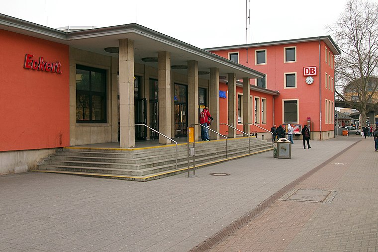
Photo: BlueBreezeWiki, CC BY-SA 3.0.
Speyer Hauptbahnhof is the more important of the two railway stations in the city of Speyer in the German state of Rhineland-Palatinate. Speyer Hauptbahnhof is situated 650 metres southwest of Freie evangelische Gemeinde Speyer.
Old Cemetery
Park

Photo: BlueBreezeWiki, CC BY-SA 3.0.
Old Cemetery is a park, which is situated 560 metres southwest of Freie evangelische Gemeinde Speyer.
Places in the Area
Nearby places include Otterstadt and Altlußheim.
Otterstadt
Village

Photo: Frank-m, CC BY-SA 2.5.
Otterstadt is a municipality in the Rhein-Pfalz-Kreis, in Rhineland-Palatinate, Germany. The almost 980-year-old village was once a pure agricultural and fishing village. Otterstadt is situated 5 km north of Freie evangelische Gemeinde Speyer.
Altlußheim
Village
Altlußheim is a municipality in Baden-Württemberg and belongs to Rhein-Neckar-Kreis. Altlußheim sits in the Rhine rift directly on the right bank of a meandering of the Rhine, where the Kriegbach flows into the Rhine. Altlußheim is situated 5 km southeast of Freie evangelische Gemeinde Speyer.
Römerberg
Village
Römerberg is a municipality in the Rhein-Pfalz-Kreis, in Rhineland-Palatinate, Germany. It is situated on the left bank of the Rhine, approximately 5 kilometres southwest of Speyer. Römerberg is situated 6 km southwest of Freie evangelische Gemeinde Speyer.
Freie evangelische Gemeinde Speyer
- Categories: place of worship and religion
- Location: Speyer, Palatinate, Rhineland-Palatinate, Germany, Central Europe, Europe
- View on OpenStreetMap
Latitude
49.32644° or 49° 19′ 35″ northLongitude
8.43662° or 8° 26′ 12″ eastOpen location code
8FXC8CGP+HJOpenStreetMap ID
node 6343956744OpenStreetMap feature
amenity=place_of_worship
This page is based on OpenStreetMap, Wikidata, and Wikimedia Commons.
We’d love your help improving our open data sources. Thank you for contributing.
Satellite Map
Discover Freie evangelische Gemeinde Speyer from above in high-definition satellite imagery.
Notable Places Nearby
Highlights include Tanz-Treff-Thiele and Athletenverein 1903 e.V. Speyer.
Nearby Places
Explore places such as Porta Nuova 2 am Sportpark and Kindertagesstätte Mäuseburg.
Palatinate: Must-Visit Destinations
Delve into Ludwigshafen, Kaiserslautern, Pirmasens, and Landau in der Pfalz.
Curious Churches to Discover
Uncover intriguing churches from every corner of the globe.
About Mapcarta. Data © OpenStreetMap contributors and available under the Open Database License". Text is available under the CC BY-SA 4.0 license, except for photos, directions, and the map. Photo: Wikimedia, CC0.