Ninth Avenue
Ninth Avenue is a bus stop in York, England. Ninth Avenue is situated nearby to the park Eighth Avenue Playing Field, as well as near the school Tang Hall Primary Academy.| Tap on a place to explore it |
Places of Interest Nearby
Highlights include York Minster and Church of Holy Trinity.
York Minster
Church
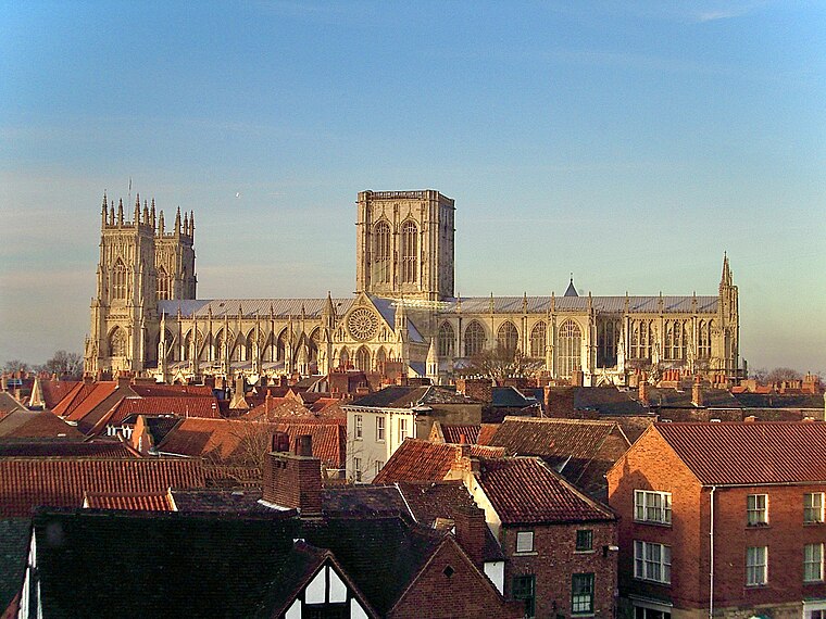
Photo: MatzeTrier, CC BY-SA 3.0.
York Minster, formally the Cathedral and Metropolitical Church of Saint Peter in York, is an Anglican cathedral in the city of York, North Yorkshire, England. York Minster is situated 1 mile west of Ninth Avenue.
Church of Holy Trinity
Church

Photo: Malcolmxl5, CC BY-SA 4.0.
Church of Holy Trinity is situated 1,000 feet north of Ninth Avenue.
Heworth Church of England Primary Academy
School

Photo: Malcolmxl5, CC BY-SA 4.0.
Heworth Church of England Primary Academy is a school, which is situated 1,400 feet north of Ninth Avenue.
Places in the Area
Nearby places include Heworth and Tang Hall.
Heworth
Suburb
Photo: Malcolmxl5, CC BY-SA 4.0.
Heworth is part of the city of York in North Yorkshire, England, about 1 mile north-east of the centre. No longer in general referred to as a village, "Heworth Village" is now the name of a specific road.
Tang Hall
Suburb

Photo: DS Pugh, CC BY-SA 2.0.
Tang Hall is a suburban district of the city of York in North Yorkshire, England. The name is derived from the Anglo Saxon Tang, which means the meeting place of two becks, and a Hall that stood on Fourth Avenue until the 1970s.
Layerthorpe
Suburb
Layerthorpe is a part of the city of York in, North Yorkshire, England. It is outside the city walls of York. The road through Layerthorpe from the bridge over the River Foss to Heworth is also shares the same name.
Ninth Avenue
- Type: Bus stop
- Category: transportation
- Location: York, England, United Kingdom, Britain and Ireland, Europe
- View on OpenStreetMap
Latitude
53.9634° or 53° 57′ 48″ northLongitude
-1.05842° or 1° 3′ 30″ westNetwork
20, 25Open location code
9C5WXW7R+9JOpenStreetMap ID
node 6348539310OpenStreetMap feature
highway=bus_stopOpenStreetMap feature
public_transport=platform
This page is based on OpenStreetMap, Wikidata, and Wikimedia Commons.
We’d love your help improving our open data sources. Thank you for contributing.
Satellite Map
Discover Ninth Avenue from above in high-definition satellite imagery.
Places with the Same Name
Discover other places named “Ninth Avenue”.
Notable Places Nearby
Highlights include Eighth Avenue Playing Field and Heworth Church Hall.
Nearby Places
Explore places such as Ninth Avenue and Olivia Jayne.
England: Must-Visit Destinations
Delve into London, Manchester, Sheffield, and Leeds.
Curious Bus Stops to Discover
Uncover intriguing bus stops from every corner of the globe.
About Mapcarta. Data © OpenStreetMap contributors and available under the Open Database License". Text is available under the CC BY-SA 4.0 license, except for photos, directions, and the map. Photo: sidibousaid, CC BY 2.0.