Resolve
Resolve is a social service facility in Hatfield, Hertfordshire, England. Resolve is situated nearby to Gracemead Church, as well as near the marketplace Farmer’s & Craft Market.| Tap on a place to explore it |
Places of Interest Nearby
Highlights include Hatfield House and The Town Inn.
Hatfield House
Manor estate
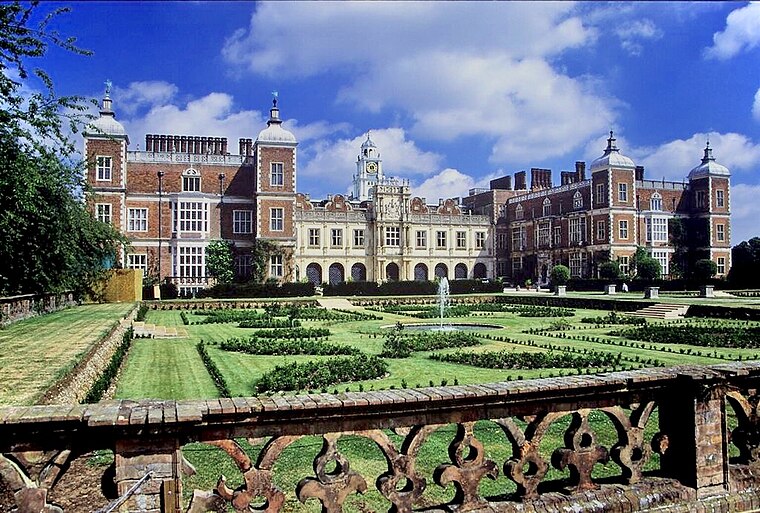
Photo: Allan Engelhardt, CC BY-SA 2.0.
Hatfield House is a Grade I listed country house set in a large park, the Great Park, on the eastern side of Hatfield, Hertfordshire, England. The present Jacobean house, a leading example of the prodigy house, was built in 1611 by Robert Cecil, 1st Earl of Salisbury and Chief Minister to King James I. Hatfield House is situated 4,100 feet east of Resolve.
The Town Inn
Pub

Photo: RobThinks, CC BY-SA 4.0.
The Town Inn is a pub, which is situated 460 feet east of Resolve.
Hatfield railway station
Railway station

Photo: Cmglee, CC BY-SA 3.0.
Hatfield railway station serves the town of Hatfield in Hertfordshire, England. The station is managed by Great Northern. It is 17 miles 54 chains measured from London King's Cross on the East Coast Main Line. Hatfield railway station is situated 2,800 feet east of Resolve.
Places in the Area
Nearby places include Old Hatfield and Sleapshyde.
Old Hatfield
Suburb
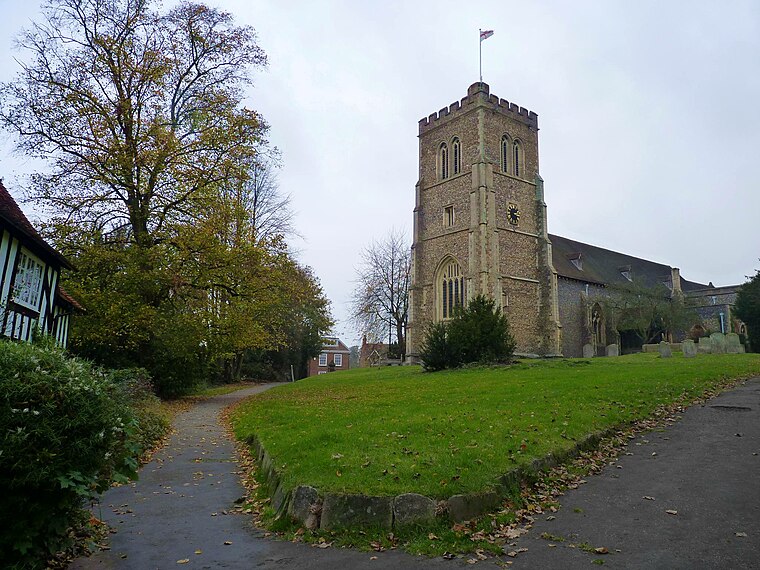
Photo: Cmglee, CC BY-SA 3.0.
Old Hatfield, sometimes called Bishops Hatfield, is a historic village in Hertfordshire, England. It is in the town of Hatfield. It grew up on the Great North Road, one day's journey from London by horse or coach and once had many coaching inns.
Sleapshyde
Hamlet
Sleapshyde is a small village in Hertfordshire, United Kingdom. It is located between Hatfield and St Albans, to the south of Smallford and to the north of Colney Heath, of which it is located in the civil parish of. Sleapshyde is situated 1½ miles southwest of Resolve.
Smallford
Hamlet

Photo: Jack Hill, CC BY-SA 2.0.
Smallford is a village in the City and District of St Albans, Hertfordshire, United Kingdom. It is sandwiched between Hatfield and St Albans. It was served by Smallford railway station on the Hatfield and St Albans Railway, now the Alban Way cycle path. Smallford is situated 2 miles west of Resolve.
Resolve
Latitude
51.76233° or 51° 45′ 44″ northLongitude
-0.22718° or 0° 13′ 38″ westOpen location code
9C3XQQ6F+W4OpenStreetMap ID
node 6357359878OpenStreetMap feature
amenity=social_facility
This page is based on OpenStreetMap, Wikidata, and Wikimedia Commons.
We’d love your help improving our open data sources. Thank you for contributing.
Satellite Map
Discover Resolve from above in high-definition satellite imagery.
Places with the Same Name
Discover other places named “Resolve”.
Notable Places Nearby
Highlights include Gracemead Church and Farmer’s & Craft Market.
Nearby Places
Explore places such as SPARKS Community Cafe and Queensway House.
Hertfordshire: Must-Visit Destinations
Delve into St Albans, Watford, Stevenage, and Hertford.
Curious Social Service Facilities to Discover
Uncover intriguing social service facilities from every corner of the globe.
About Mapcarta. Data © OpenStreetMap contributors and available under the Open Database License". Text is available under the CC BY-SA 4.0 license, except for photos, directions, and the map. Photo: RobThinks, CC BY-SA 4.0.