Via Romagna
Via Romagna is a tram stop in Trieste, Friuli-Venezia Giulia. Via Romagna is situated nearby to the peak Colle di Scorcola, as well as near the historic building Castelletto Geiringer.| Tap on a place to explore it |
Places of Interest Nearby
Highlights include Castelletto Geiringer and Trieste Centrale railway station.
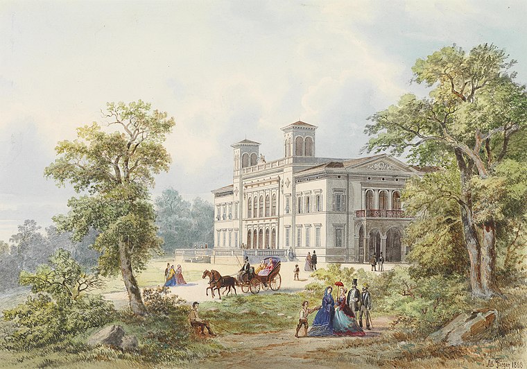
Castelletto Geiringer
Historic building

Photo: European School of Trieste, CC BY-SA 3.0.
Castelletto Geiringer is a historic building, which is situated 170 metres northeast of Via Romagna.
Trieste Centrale railway station
Railway station

Photo: Simon04, CC BY-SA 4.0.
Trieste Centrale railway station is the main station serving the city and municipality of Trieste, in the autonomous region of Friuli-Venezia Giulia, northeastern Italy. Trieste Centrale railway station is situated 640 metres southwest of Via Romagna.
Synagogue of Trieste
Synagogue

Photo: Andrzej O, CC BY-SA 4.0.
The Synagogue of Trieste, also the Great Synagogue of Trieste, is an Orthodox Jewish congregation and synagogue, that is located at Via S. Francesco D'Assisi 19, Trieste, in Friuli-Venezia Giulia, in Northern Italy. Synagogue of Trieste is situated 1 km south of Via Romagna.
Places in the Area
Nearby places include Sottomonte and Chiadino.

Barcola
Suburb

Photo: Tiesse, Public domain.
Barcola is a maritime neighbourhood of Trieste, Italy. It is a popular tourist destination with beaches and long promenades, near the Habsburg-established Miramare Castle. Barcola is situated 3 km northwest of Via Romagna.
Via Romagna
- Type: Tram stop
- Categories: railway stop, transport stop, and transportation
- Location: Trieste, Province of Trieste, Friuli-Venezia Giulia, Northeast Italy, Italy, Europe
- View on OpenStreetMap
Latitude
45.66133° or 45° 39′ 41″ northLongitude
13.77843° or 13° 46′ 42″ eastOperator
TPL FVGNetwork
Trieste TrasportiOpen location code
8FQMMQ6H+G9OpenStreetMap ID
node 637492652OpenStreetMap feature
public_transport=stop_positionOpenStreetMap feature
railway=tram_stop
This page is based on OpenStreetMap, Wikidata, and Wikimedia Commons.
We’d love your help improving our open data sources. Thank you for contributing.
Satellite Map
Discover Via Romagna from above in high-definition satellite imagery.
Notable Places Nearby
Highlights include Via Romagna and Colle di Scorcola.
Nearby Places
Explore places such as Via Cantù and European School of Trieste.
Friuli-Venezia Giulia: Must-Visit Destinations
Delve into Udine, Aquileia, Gorizia, and Pordenone.
Curious Tram Stops to Discover
Uncover intriguing tram stops from every corner of the globe.
About Mapcarta. Data © OpenStreetMap contributors and available under the Open Database License". Text is available under the CC BY-SA 4.0 license, except for photos, directions, and the map. Photo: Dodos2013, CC BY-SA 3.0.