Indigo Palmes
Indigo Palmes is a chalet in Guadeloupe. Indigo Palmes is situated nearby to Comté de Lohéac, as well as near the beach Plage Mambia.| Tap on a place to explore it |
Places of Interest Nearby
Highlights include Église Sainte-Rose-de-Lima de Sainte-Rose and Plage de Clugny.
Église Sainte-Rose-de-Lima de Sainte-Rose
Church

Photo: Enrevseluj, CC BY-SA 4.0.
Église Sainte-Rose-de-Lima de Sainte-Rose is a church, which is situated 2½ km east of Indigo Palmes.
Plage de Clugny
Beach

Photo: FreeProuilhe, CC BY-SA 4.0.
Plage de Clugny is a beach, which is situated 3½ km west of Indigo Palmes.
Cemetery of Sainte-Rose
Cemetery

Photo: KoS, CC BY-SA 3.0.
Cemetery of Sainte-Rose is situated 2½ km east of Indigo Palmes.
Places in the Area
Nearby places include Pointe Nogent and Sainte-Rose.

Sainte-Rose
Town
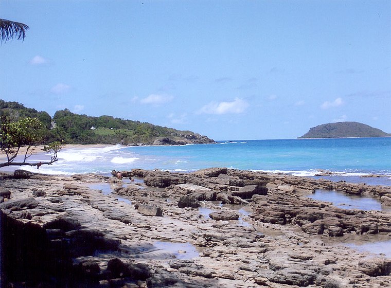
Photo: Wikimedia, CC BY-SA 3.0.
Sainte-Rose is a commune in the department of Guadeloupe. It is the second largest commune of Guadeloupe, in terms of area, after Petit-Bourg. Sainte-Rose lies on the coast of the island of Basse-Terre. Sainte-Rose is situated 2½ km southeast of Indigo Palmes.
Deshaies
Town

Photo: LPLT, CC BY-SA 3.0.
Deshaies is a commune in the French overseas region and department of Guadeloupe, in the Lesser Antilles. It is on the northwest coast of Basse-Terre Island. The inhabitants are called Deshaisiens. Deshaies is situated 9 km southwest of Indigo Palmes.
Indigo Palmes
- Type: Chalet
- Categories: tourism, accommodation, and building
- Location: Guadeloupe, Lesser Antilles, Caribbean, North America
- View on OpenStreetMap
Latitude
16.34206° or 16° 20′ 31″ northLongitude
-61.72063° or 61° 43′ 14″ westOpen location code
778W87RH+RPOpenStreetMap ID
node 6377025844OpenStreetMap feature
tourism=chalet
This page is based on OpenStreetMap, Wikidata, and Wikimedia Commons.
We’d love your help improving our open data sources. Thank you for contributing.
Satellite Map
Discover Indigo Palmes from above in high-definition satellite imagery.
Notable Places Nearby
Highlights include Comté de Lohéac and Plage Mambia.
Nearby Places
Explore places such as Habitation du Compté and Accueil Habitation du Comté.
Guadeloupe: Must-Visit Destinations
Delve into Pointe-à-Pitre, Sainte-Anne, Basse-Terre, and Grande-Terre.
Curious Chalets to Discover
Uncover intriguing chalets from every corner of the globe.
About Mapcarta. Data © OpenStreetMap contributors and available under the Open Database License". Text is available under the CC BY-SA 4.0 license, except for photos, directions, and the map. Photo: Patrice78500, CC BY-SA 3.0.