Centre d’intervention et de prévention en toxicomanie de l’Outaouais
Centre d’intervention et de prévention en toxicomanie de l’Outaouais is a social service facility in Outaouais, Quebec. Centre d’intervention et de prévention en toxicomanie de l’Outaouais is situated nearby to the park Parc du Carré-Vaudreuil, as well as near the community center Centre Jules-Desbiens.| Tap on a place to explore it |
Places of Interest Nearby
Highlights include Canadian Museum of History and Library and Archives Canada.
Canadian Museum of History
Museum

Photo: Taxiarchos228, CC BY 3.0.
The Canadian Museum of History is a national museum on anthropology, Canadian history, cultural studies, and ethnology in Gatineau, Quebec, Canada. The purpose of the museum is to promote the heritage of Canada, as well as support related research. Canadian Museum of History is situated 1 km east of Centre d’intervention et de prévention en toxicomanie de l’Outaouais.
Library and Archives Canada
Library
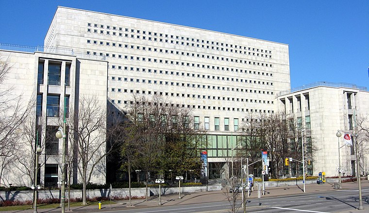
Photo: Wikimedia, CC BY-SA 3.0.
Library and Archives Canada is the federal institution tasked with acquiring, preserving, and providing accessibility to the documentary heritage of Canada. Library and Archives Canada is situated 1¼ km southeast of Centre d’intervention et de prévention en toxicomanie de l’Outaouais.
Canadian War Museum
Museum
 The Canadian War Museum is a national museum on the country's military history in Ottawa, Ontario, Canada. The museum serves as both an educational facility on Canadian military history and a place of remembrance. Canadian War Museum is situated 1¼ km south of Centre d’intervention et de prévention en toxicomanie de l’Outaouais.
Places in the Area
Nearby places include Gatineau and ByWard Market.
Gatineau

Photo: Óðinn, CC BY-SA 2.5 ca.
Gatineau is a city in the Outaouais region of Quebec, on the north shore of the Ottawa River, across from Canada's capital, Ottawa. It is part of the official National Capital Region which constitutes the fourth largest urban area in the country, after Toronto, Montreal and Vancouver.
ByWard Market
Neighborhood

Photo: Trappy, CC BY-SA 3.0.
The ByWard Market, is a retail and entertainment district in the downtown core of Ottawa, Ontario, Canada. It is located east of the government and business district.
Centre d’intervention et de prévention en toxicomanie de l’Outaouais
- Type: Social service facility
- Location: Outaouais, Quebec, Canada, North America
- View on OpenStreetMap
Latitude
45.4286° or 45° 25′ 43″ northLongitude
-75.71918° or 75° 43′ 9″ westOpen location code
87Q6C7HJ+C8OpenStreetMap ID
node 6386116793OpenStreetMap feature
amenity=social_facility
This page is based on OpenStreetMap, Wikidata, and Wikimedia Commons.
We’d love your help improving our open data sources. Thank you for contributing.
Satellite Map
Discover Centre d’intervention et de prévention en toxicomanie de l’Outaouais from above in high-definition satellite imagery.
Notable Places Nearby
Highlights include Parc du Carré-Vaudreuil and Centre Jules-Desbiens.
Nearby Places
Explore places such as Centre de Pédiatrie Sociale de Gatineau and Kulture Foods.
Outaouais: Must-Visit Destinations
Delve into Gatineau, Montebello, Wakefield, and Bristol.
Curious Social Service Facilities to Discover
Uncover intriguing social service facilities from every corner of the globe.
About Mapcarta. Data © OpenStreetMap contributors and available under the Open Database License". Text is available under the CC BY-SA 4.0 license, except for photos, directions, and the map. Photo: Cossette.phil, CC BY-SA 3.0.