Red Bone Tattoo
Red Bone Tattoo is a tattoo parlor in Thuringia, Germany. Red Bone Tattoo is situated nearby to the school Westschule, as well as near the park Friedensberg.| Tap on a place to explore it |
- Opening hours: Monday—Friday 2:00 PM—8:00 PM
- Type: Tattoo parlor
- Wheelchair access: no
Places of Interest Nearby
Highlights include Evangelisch-methodistische Kirche and Ernst-Abbe-Denkmal.
Evangelisch-methodistische Kirche
Church

Photo: Reise Reise, CC BY-SA 4.0.
Evangelisch-methodistische Kirche is a church, which is situated 390 metres north of Red Bone Tattoo.

Markus-Kirche
Church

Photo: Reise Reise, CC BY-SA 4.0.
Markus-Kirche is a church, which is situated 450 metres northeast of Red Bone Tattoo.
Places in the Area
Nearby places include Jena and Damenviertel.
Jena
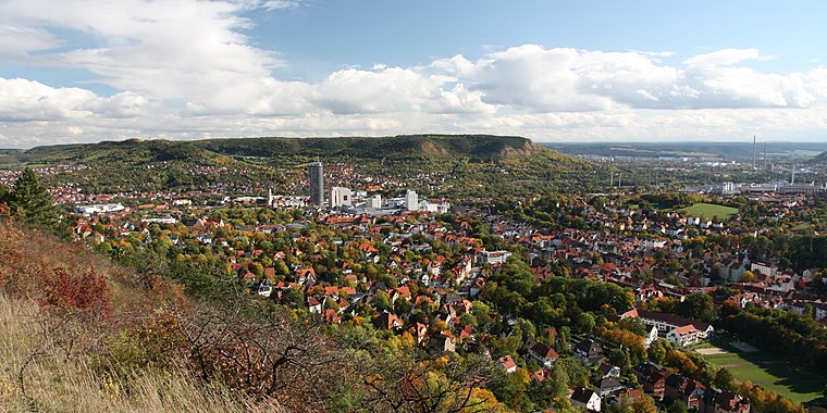
Photo: Lars0001, Public domain.
Jena is a city in the central German state of Thuringia. It is a centre of science and technology with a reputable university, several research institutes and high-tech plants, especially focusing on precision mechanics and optical industries.

Ammerbach
Suburb

Photo: Hamster3, CC BY-SA 3.0.
Ammerbach is a suburb, which is situated 3 km south of Red Bone Tattoo.
Red Bone Tattoo
- Category: shop
- Location: Thuringia, Germany, Central Europe, Europe
- View on OpenStreetMap
Latitude
50.9298° or 50° 55′ 47″ northLongitude
11.57076° or 11° 34′ 15″ eastOpen location code
9F2HWHHC+W8OpenStreetMap ID
node 6387858780OpenStreetMap feature
shop=tattooOpenStreetMap attribute
wheelchair=no
This page is based on OpenStreetMap, Wikidata, and Wikimedia Commons.
We’d love your help improving our open data sources. Thank you for contributing.
Satellite Map
Discover Red Bone Tattoo from above in high-definition satellite imagery.
Notable Places Nearby
Highlights include Westschule and Friedensberg.
Nearby Places
Explore places such as Washmaids and Katharinenstraße.
Curious Tattoo Parlors to Discover
Uncover intriguing tattoo parlors from every corner of the globe.
About Mapcarta. Data © OpenStreetMap contributors and available under the Open Database License". Text is available under the CC BY-SA 4.0 license, except for photos, directions, and the map. Photo: Taxiarchos228, FAL.