Im oberen Busch
Im oberen Busch is a locality in Rhineland-Palatinate, Germany. Im oberen Busch is situated nearby to the locality Oberer Busch, as well as near Mittlerer Busch.| Tap on a place to explore it |
Places of Interest
Highlights include Kieswerk Bonnau and Lampertheimer Altrhein.

Lampertheimer Altrhein
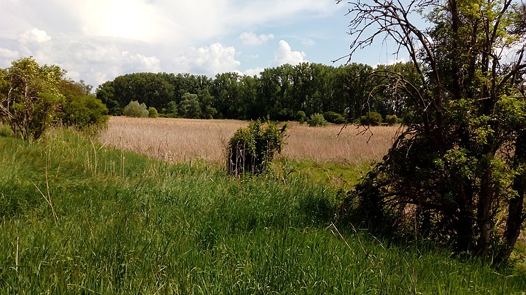
Nature reserve

Photo: Aquatoney, CC BY-SA 4.0.
Lampertheimer Altrhein is a nature reserve.
Places in the Area
Nearby places include Bobenheim-Roxheim and Worms.
Bobenheim-Roxheim
Village

Photo: Jivee Blau, CC BY-SA 3.0.
Bobenheim-Roxheim is a municipality in the Rhein-Pfalz-Kreis, in Rhineland-Palatinate, Germany. It is situated approximately 5 km south of Worms, and 13 km northwest of Ludwigshafen. Bobenheim-Roxheim is situated 3½ km southwest of Im oberen Busch.
Worms

Photo: Pratz53, CC BY-SA 4.0.
Worms is a city in the Rhineland-Palatinate region of Germany. You can still see many vestiges of the old city walls, particularly the Torturmplatz and the Karolingerstraße.
Horchheim
Suburb

Photo: PMScigne, Public domain.
Horchheim is a suburb, which is situated 6 km west of Im oberen Busch.
Im oberen Busch
- Type: Locality
- Location: Rhineland-Palatinate, Germany, Central Europe, Europe
- View on OpenStreetMap
Latitude
49.59722° or 49° 35′ 50″ northLongitude
8.40587° or 8° 24′ 21″ eastOpen location code
8FXCHCW4+V8OpenStreetMap ID
node 6393702353OpenStreetMap feature
place=locality
This page is based on OpenStreetMap, Wikidata, and Wikimedia Commons.
We’d love your help improving our open data sources. Thank you for contributing.
Satellite Map
Discover Im oberen Busch from above in high-definition satellite imagery.
Localities in the Area
Explore places such as Im oberen Busch and Oberer Busch.
Notable Places Nearby
Highlights include Freilichtbühne im Busch and Müllberg.
Rhineland-Palatinate: Must-Visit Destinations
Delve into Mainz, Trier, Koblenz, and Worms.
Curious Localities to Discover
Uncover intriguing localities from every corner of the globe.
About Mapcarta. Data © OpenStreetMap contributors and available under the Open Database License". Text is available under the CC BY-SA 4.0 license, except for photos, directions, and the map. Photo: Traveler100, CC BY-SA 3.0.