Terminal Porto
Terminal Porto is a railway station in Santos and South Coast, São Paulo. Terminal Porto is situated nearby to Pátio Porto, as well as near the university Unilus.| Tap on a place to explore it |
Places of Interest Nearby
Highlights include Washington Luís Station and Universidades II.
Washington Luís Station
Railway stop

Photo: Governo do Estado de São Paulo, CC BY 2.0.
Washington Luís Station is a railway stop, which is situated 1½ km west of Terminal Porto.
Universidades II
Railway stop
 Universidades II is a railway stop, which is situated 1½ km northwest of Terminal Porto.
Places in the Area
Nearby places include Centro and Santos.
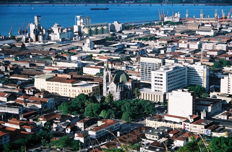
Santos

Photo: Wikimedia, CC BY-SA 2.0.
Santos is a city in the south of the state of São Paulo, Brazil. Santos is the core city of Baixada Santista, a coastal metropolitan area, and contains the most important port in South America.

Terminal Porto
- Type: Railway station
- Also known as: “Estação Porto”
- Categories: station and transportation
- Location: Santos and South Coast, São Paulo, Southeast, Brazil, South America
- View on OpenStreetMap
Latitude
-23.95692° or 23° 57′ 25″ southLongitude
-46.31357° or 46° 18′ 49″ westOperator
EMTUOpen location code
588M2MVP+6HOpenStreetMap ID
node 6399257813OpenStreetMap feature
public_transport=stationOpenStreetMap feature
railway=station
This page is based on OpenStreetMap, Wikidata, and Wikimedia Commons.
We’d love your help improving our open data sources. Thank you for contributing.
Satellite Map
Discover Terminal Porto from above in high-definition satellite imagery.
Places with the Same Name
Discover other places named “Terminal Porto”.
Notable Places Nearby
Highlights include Pátio Porto and Unilus.
Nearby Places
Explore places such as Terminal Porto and EMTU - Empresa Metropolitana de Transportes Urbanos - Santos.
Santos and South Coast: Must-Visit Destinations
Delve into Santos, Guarujá, São Vicente, and Cubatão.
Curious Railway Stations to Discover
Uncover intriguing railway stations from every corner of the globe.
About Mapcarta. Data © OpenStreetMap contributors and available under the Open Database License". Text is available under the CC BY-SA 4.0 license, except for photos, directions, and the map. Photo: Governo do Estado de São Paulo, CC BY 2.0.