El Tatú
El Tatú is a café in Alicante, Costa Blanca, Valencian Community. El Tatú is situated nearby to the square Plaça de la Ciutat de la Justícia - Plaza de la Ciudad de la Justicia, as well as near the school Col·legi d’Educació Infantil i Primària José Carlos Aguilera.| Tap on a place to explore it |
Places of Interest Nearby
Highlights include Alicante Railway Station and Estadio José Rico Pérez.
Alicante Railway Station
Railway station

Photo: FDV, CC BY-SA 4.0.
Alicante Terminal is the central railway station of Alicante, Spain. Commonly referred locally as the RENFE station, the station is part of Adif system, and is a terminal station. Alicante Railway Station is situated 730 metres east of El Tatú.
Estadio José Rico Pérez
Stadium
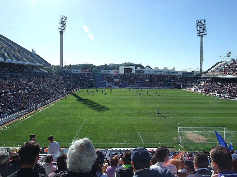
Photo: Wikimedia, Public domain.
Estadio José Rico Pérez is a multi-purpose stadium in Alicante, Spain. It is currently used mostly for football matches, being home to Hércules CF. It also hosted World Cup matches when Spain organized the event in 1982. Estadio José Rico Pérez is situated 1½ km northeast of El Tatú.
Teatre Arniches
Theater building
 Teatre Arniches is a theater building, which is situated 790 metres east of El Tatú.
Places in the Area
Nearby places include Asis and Gran Via Sud.


El Tatú
- Type: Café
- Location: Alicante, Costa Blanca, Alicante, Valencian Community, Eastern Spain, Spain, Iberia, Europe
- View on OpenStreetMap
Latitude
38.34487° or 38° 20′ 42″ northLongitude
-0.50377° or 0° 30′ 14″ westOpen location code
8CCX8FVW+WFOpenStreetMap ID
node 6407458095OpenStreetMap feature
amenity=cafe
This page is based on OpenStreetMap, Wikidata, and Wikimedia Commons.
We’d love your help improving our open data sources. Thank you for contributing.
Satellite Map
Discover El Tatú from above in high-definition satellite imagery.
Places with the Same Name
Discover other places named “El Tatú”.
Notable Places Nearby
Highlights include Plaça de la Ciutat de la Justícia - Plaza de la Ciudad de la Justicia and Col·legi d’Educació Infantil i Primària José Carlos Aguilera.
Nearby Places
Explore places such as Style Brothers and Sucre.
Costa Blanca: Must-Visit Destinations
Delve into Elche, Benidorm, Torrevieja, and Dénia.
Curious Cafés to Discover
Uncover intriguing cafés from every corner of the globe.
About Mapcarta. Data © OpenStreetMap contributors and available under the Open Database License". Text is available under the CC BY-SA 4.0 license, except for photos, directions, and the map. Photo: sergiomas, CC BY 2.0.