Iglesia Betel Santiago
Iglesia Betel Santiago is a church in Huixquilucan Municipality, Mexico State. Iglesia Betel Santiago is situated nearby to the amusement arcade Maquinitas Aurora, as well as near the church Iglesia de Santiago Yancuitlalpan.| Tap on a place to explore it |
Places of Interest Nearby
Highlights include Suburbia and Torre Altus.
Suburbia
Clothing store
Suburbia is a Mexican chain of department stores now part of the El Puerto de Liverpool group and founded in 1970 in Mexico City. Its main activity consists of the sale of clothing, appliances, electronics and cell phones aimed at the middle and lower economic classes. Suburbia is situated 3½ km southeast of Iglesia Betel Santiago.
Torre Altus
Apartment building
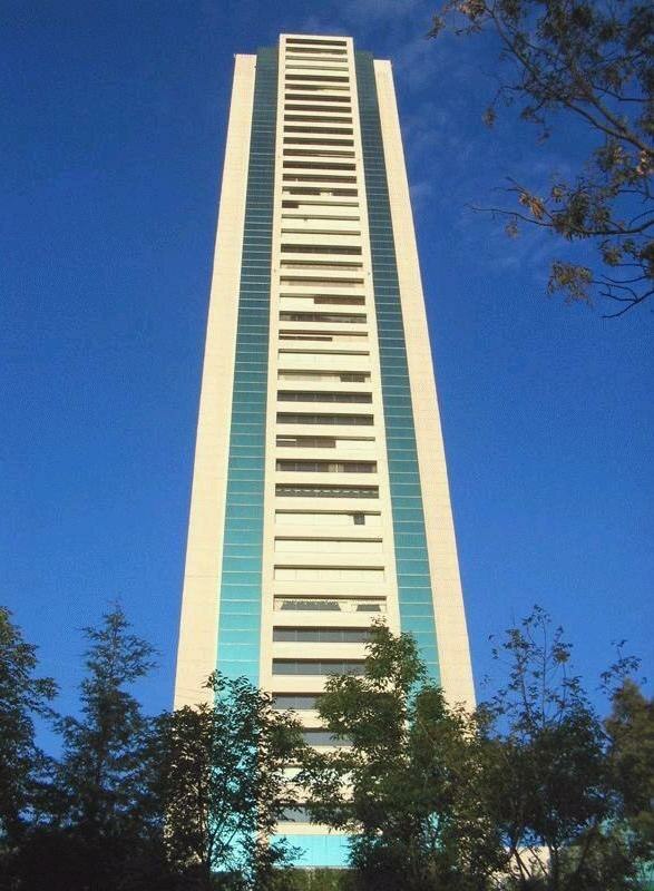
Photo: Wikimedia, Public domain.
Torre Altus is one of the tallest skyscrapers in Mexico City, Mexico. It is a residential condominium tower located on Paseo de los Laureles y Alcanfores in the Bosques de las Lomas district of the Miguel Hidalgo borough in the city. Torre Altus is situated 4 km east of Iglesia Betel Santiago.
Places in the Area
Nearby places include Santa Fe and Bosques de las Lomas.
Santa Fe

Photo: Serge Saint, CC BY 2.0.
Santa Fe is in the western area of Mexico City. It is the newest and most modern district of the city, as almost all of it has been developed only in the past twenty years; this puts this district in stark contrast with Mexico City's other districts, especially the Centro Historico.
Bosques de las Lomas
Neighborhood
Bosques de las Lomas is a colonia, or officially recognised neighbourhood, located in western Mexico City. It falls partly in Cuajimalpa borough and partly in Miguel Hidalgo borough. Bosques de las Lomas is situated 6 km east of Iglesia Betel Santiago.
Santa Fe de Mexico
Village
Santa Fé de México was a Pueblo Hospital founded by Vasco de Quiroga in 1532. Its ruins are located in the town of Santa Fé in the delegación of Álvaro Obregón in western Mexico City. Santa Fe de Mexico is situated 7 km east of Iglesia Betel Santiago.
Iglesia Betel Santiago
- Type: Church
- Categories: place of worship and religion
- Location: Huixquilucan Municipality, Mexico State, Central Mexico, Mexico, North America
- View on OpenStreetMap
Latitude
19.38841° or 19° 23′ 18″ northLongitude
-99.30319° or 99° 18′ 12″ westOpen location code
76F29MQW+9POpenStreetMap ID
node 6429454508OpenStreetMap feature
amenity=place_of_worship
This page is based on OpenStreetMap, Wikidata, and Wikimedia Commons.
We’d love your help improving our open data sources. Thank you for contributing.
Satellite Map
Discover Iglesia Betel Santiago from above in high-definition satellite imagery.
Notable Places Nearby
Highlights include Maquinitas Aurora and Iglesia de Santiago Yancuitlalpan.
Nearby Places
Explore places such as Estancia Infantil campanita and Kinder Campanita.
Mexico State: Must-Visit Destinations
Delve into Tequixquiac, Toluca, Teotihuacan, and Ecatepec.
Curious Churches to Discover
Uncover intriguing churches from every corner of the globe.
About Mapcarta. Data © OpenStreetMap contributors and available under the Open Database License". Text is available under the CC BY-SA 4.0 license, except for photos, directions, and the map. Photo: Wikimedia, CC0.