Pegel Cochem 2 / Endertbach
Pegel Cochem 2 / Endertbach is a monitoring station in Cochem, Moselle Valley, Rhineland-Palatinate. Pegel Cochem 2 / Endertbach is situated nearby to the ruins Ruine Winneburg, as well as near Bergfried.| Tap on a place to explore it |
Places of Interest Nearby
Highlights include Wild- und Freizeitpark Klotten and Bahnhof Cochem.
Wild- und Freizeitpark Klotten
Theme park

Photo: Wolkenkratzer, CC BY-SA 4.0.
Wild- und Freizeitpark Klotten is a theme park, which is situated 1½ km east of Pegel Cochem 2 / Endertbach.
Bahnhof Cochem
Railway station

Photo: Historiograf, CC BY 2.0.
Bahnhof Cochem is a railway station, which is situated 2½ km southeast of Pegel Cochem 2 / Endertbach.
Enderttor
City gate
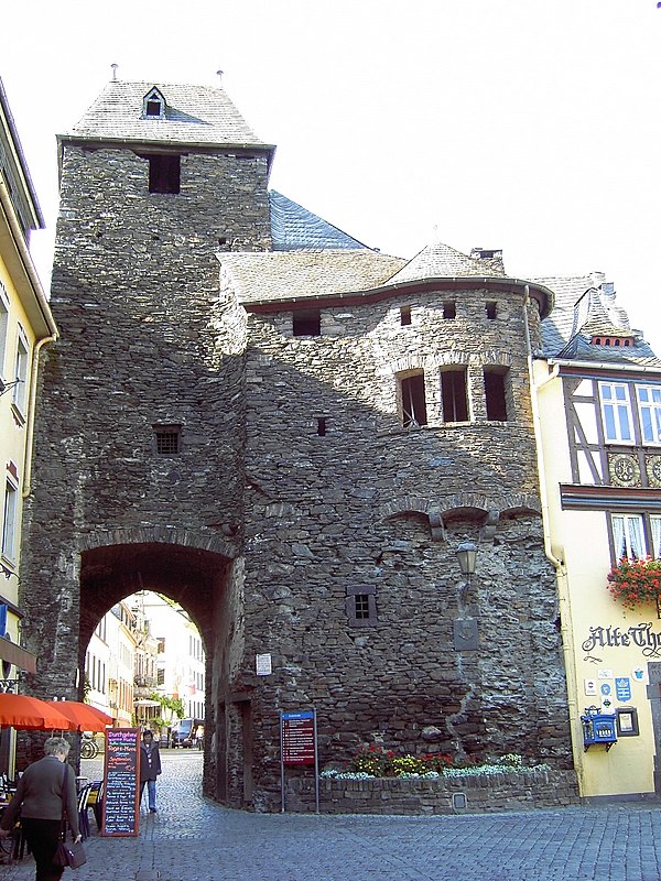 Enderttor is a city gate, which is situated 2½ km southeast of Pegel Cochem 2 / Endertbach.
Places in the Area
Nearby places include Winneburg and Faid.

Faid
Village

Photo: Reinhardhauke, CC BY-SA 3.0.
Faid is an Ortsgemeinde – a municipality belonging to a Verbandsgemeinde, a kind of collective municipality – in the Cochem-Zell district in Rhineland-Palatinate, Germany. It belongs to the Verbandsgemeinde of Cochem, whose seat is in the like-named town.
Greimersburg
Village

Photo: Reinhardhauke, CC BY-SA 3.0.
Greimersburg is an Ortsgemeinde – a municipality belonging to a Verbandsgemeinde, a kind of collective municipality – in the Cochem-Zell district in Rhineland-Palatinate, Germany. Greimersburg is situated 2½ km north of Pegel Cochem 2 / Endertbach.
Pegel Cochem 2 / Endertbach
- Type: Monitoring station
- Location: Cochem, Cochem-Zell, Moselle Valley, Rhineland-Palatinate, Germany, Central Europe, Europe
- View on OpenStreetMap
Latitude
50.16229° or 50° 9′ 44″ northLongitude
7.13798° or 7° 8′ 17″ eastInception
January 1st, 1976Operator
Struktur und Genehmigungsdirektion Nord Regionalstelle Wasserwirtschaft, Abfallwirtschaft, Bodenschutz KoblenzOpen location code
9F29546Q+W5OpenStreetMap ID
node 6445101918OpenStreetMap feature
man_made=monitoring_station
This page is based on OpenStreetMap, Wikidata, and Wikimedia Commons.
We’d love your help improving our open data sources. Thank you for contributing.
Satellite Map
Discover Pegel Cochem 2 / Endertbach from above in high-definition satellite imagery.
Notable Places Nearby
Highlights include Ruine Winneburg and Bergfried.
Nearby Places
Explore places such as Moselromantik Hotel Weißmühle and Restaurant Müllerstube.
Moselle Valley: Must-Visit Destinations
Delve into Trier, Konz, Traben-Trarbach, and Treis-Karden.
Curious Monitoring Stations to Discover
Uncover intriguing monitoring stations from every corner of the globe.
About Mapcarta. Data © OpenStreetMap contributors and available under the Open Database License". Text is available under the CC BY-SA 4.0 license, except for photos, directions, and the map. Photo: Michal Osmenda, CC BY-SA 2.0.