Brownstone Hotel
Brownstone Hotel is a residential area in Los Angeles, Southern California, California which is located on East 5th Street. Brownstone Hotel is situated nearby to the quarter Skid Row, as well as near James M Wood Community Center.| Tap on a place to explore it |
Places of Interest Nearby
Highlights include Los Angeles City Hall and Museum of Contemporary Art Los Angeles.
Los Angeles City Hall
Town hall

Photo: Brion VIBBER, CC BY-SA 3.0.
Los Angeles City Hall, completed in 1928, is the center of the government of the city of Los Angeles, California, and houses the mayor's office and the meeting chambers and offices of the Los Angeles City Council. Los Angeles City Hall is situated 3,400 feet north of Brownstone Hotel.
Museum of Contemporary Art Los Angeles
Museum
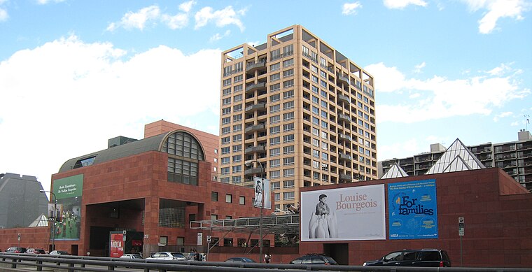
Photo: Minnaert, CC BY-SA 3.0.
The Museum of Contemporary Art, Los Angeles is a contemporary art museum with two locations in greater Los Angeles, California. The main branch is located on Grand Avenue in Downtown Los Angeles, near the Walt Disney Concert Hall. Museum of Contemporary Art Los Angeles is situated 3,800 feet northwest of Brownstone Hotel.
Cecil Hotel
Hotel

Photo: jimwinstead, CC BY 2.0.
The Cecil Hotel is an affordable housing complex in Downtown Los Angeles. It opened on December 20, 1924, as a hotel, but declined during the Great Depression and subsequent decades. Cecil Hotel is situated 2,000 feet west of Brownstone Hotel.
Places in the Area
Nearby places include Skid Row and Toy District.
Skid Row
Quarter
 Skid Row is the unofficial name for a neighborhood in Downtown Los Angeles officially known as Central City East. Skid Row contains one of the largest stable populations of homeless people in the United States, estimated at over 4,400, and has been known for its condensed homeless population since at least the 1930s.
Toy District
Neighborhood
The Toy District is a 12-block area in eastern Downtown Los Angeles, bounded by Los Angeles Street on the west, Third and Fifth streets on the north and south and San Pedro Street on the east.
Gallery Row
Neighborhood
Gallery Row is a neighborhood in downtown Los Angeles, designated by the city council in 2003 to promote the concentration of art galleries along Main and Spring Streets.
Brownstone Hotel
- Type: Residential area
- Address: 427 East 5th Street, Los Angeles, CA 90013
- Location: Los Angeles, Southern California, California, United States, North America
- View on OpenStreetMap
Latitude
34.04442° or 34° 2′ 40″ northLongitude
-118.24412° or 118° 14′ 39″ westOpen location code
85632QV4+Q9OpenStreetMap ID
node 6525682031OpenStreetMap feature
landuse=residential
This page is based on OpenStreetMap, Wikidata, and Wikimedia Commons.
We’d love your help improving our open data sources. Thank you for contributing.
Satellite Map
Discover Brownstone Hotel from above in high-definition satellite imagery.
Notable Places Nearby
Highlights include James M Wood Community Center and San Julian Park.
Nearby Places
Explore places such as Golden West and 5th & San Pedro.
Los Angeles: Must-Visit Destinations
Delve into Hollywood, San Gabriel Valley, San Fernando Valley, and Long Beach.
Curious Residential Areas to Discover
Uncover intriguing residential areas from every corner of the globe.
About Mapcarta. Data © OpenStreetMap contributors and available under the Open Database License". Text is available under the CC BY-SA 4.0 license, except for photos, directions, and the map. Photo: Mfield, CC BY-SA 3.0.