Sleydingen
Sleydingen is a work of art in Watermael-Boitsfort, Arrondissement of Brussels-Capital. Sleydingen is situated nearby to Parc de la Royale Belge - Royale Belgepark, as well as near the sports venue Mix Brussels.| Tap on a place to explore it |
Places of Interest Nearby
Highlights include Charle-Albert Castle and Tenreuken Park.
Charle-Albert Castle
Castle
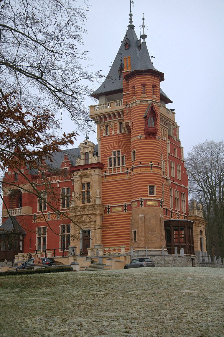
Photo: Mélioratif, CC BY-SA 4.0.
Charle-Albert Castle is situated 200 metres south of Sleydingen.

Royale Belge
Office building

Photo: Zinneke, CC BY-SA 3.0.
The Royale Belge former headquarters is a functionalist building, built 1967–1970, located in Watermael-Boitsfort, a municipality of Brussels, Belgium.
Places in the Area
Nearby places include Le Logis and Floréal.

Watermael-Boitsfort
Town

Photo: Ben2, CC BY-SA 3.0.
Watermael-Boitsfort or Watermaal-Bosvoorde, often simply called Boitsfort in French or Bosvoorde in Dutch, is one of the 19 municipalities of the Brussels-Capital Region, Belgium.
Sleydingen
- Type: Work of art
- Artwork type: statue
- Category: tourism
- Location: Watermael-Boitsfort, Arrondissement of Brussels-Capital, Brussels, Brussels Capital, Belgium, Benelux, Europe
- View on OpenStreetMap
Latitude
50.8028° or 50° 48′ 10″ northLongitude
4.42782° or 4° 25′ 40″ eastInception
1963Open location code
9F26RC3H+44OpenStreetMap ID
node 6564367418OpenStreetMap feature
tourism=artworkOpenStreetMap attribute
artwork_type=statue
This page is based on OpenStreetMap, Wikidata, and Wikimedia Commons.
We’d love your help improving our open data sources. Thank you for contributing.
Satellite Map
Discover Sleydingen from above in high-definition satellite imagery.
Notable Places Nearby
Highlights include Parc de la Royale Belge - Royale Belgepark and Mix Brussels.
Nearby Places
Explore places such as Timber and joule.
Belgium: Must-Visit Destinations
Delve into Brussels, Antwerp, Ghent, and Liège.
Curious Work Of Arts to Discover
Uncover intriguing work of arts from every corner of the globe.
About Mapcarta. Data © OpenStreetMap contributors and available under the Open Database License". Text is available under the CC BY-SA 4.0 license, except for photos, directions, and the map. Photo: Hullie, CC BY-SA 3.0.